
 Mikhaylovka
Dyrestuy
Mikhaylovka
Mayskiy
Novobessergenevka
Tersky District
Lesnoy
Tertezh
Kuz'minskiye Otverzhki
Mikhaylovka
Dyrestuy
Mikhaylovka
Mayskiy
Novobessergenevka
Tersky District
Lesnoy
Tertezh
Kuz'minskiye Otverzhki
Istoriko-Krayevedcheskiy Muzey on the map, Desnogorsk, Russian Federation
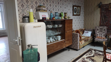
Photo
Where is located Istoriko-Krayevedcheskiy Muzey
Istoriko-Krayevedcheskiy Muzey — local attraction, which is located at 3 Mikrorayon, Desnogorsk, Smolensk Oblast, 216400 and belongs to the category — museum. Average visitor rating for this place — 4.4 (according to 47 ratings, information from open sources and relevant for 2022).
Exact location — Istoriko-Krayevedcheskiy Muzey, marked on the map with a red marker.
You can get directions to Istoriko-Krayevedcheskiy Muzey on the map from your location.
What else is interesting in Desnogorsk? You can see all the sights if you go to the city page.
Coordinates
Istoriko-Krayevedcheskiy Muzey, Russian Federation coordinates in decimal format: latitude — 54.15357193007466, longitude — 33.280686598394006. When converted to degrees, minutes, seconds Istoriko-Krayevedcheskiy Muzey has the following coordinates: 54°9′12.86 north latitude and 33°16′50.47 east longitude.
Nearby cities
The largest cities that are located nearby:
- Smolensk — 106 km
- Bryansk — 123 km
- Kaluga — 197 km
- Obninsk — 235 km
- Gomel
 (Belarus) — 245 km
 - Serpukhov — 276 km
- Tula — 280 km
- Babruysk (Belarus) — 292 km
- Velikiye Luki — 295 km
- Odintsovo — 299 km
- Podolsk — 302 km
- Izmaylovo — 314 km
- Zelenograd — 316 km
- Khimki — 322 km
- Chernihiv
 (Ukraine) — 324 km
 - Novomoskovsk — 326 km
- Navapolatsk (Belarus) — 332 km
- Lyubertsy — 334 km
- Kursk — 334 km
Distance to the capital
Distance to the capital (Moscow) is about — 329 km.