
 Mikhaylovka
Dyrestuy
Mikhaylovka
Mayskiy
Novobessergenevka
Tersky District
Lesnoy
Tertezh
Kuz'minskiye Otverzhki
Mikhaylovka
Dyrestuy
Mikhaylovka
Mayskiy
Novobessergenevka
Tersky District
Lesnoy
Tertezh
Kuz'minskiye Otverzhki
Skver Korolevy Luizy on the map, Zelenogradsk, Russian Federation
Photo
Where is located Skver Korolevy Luizy
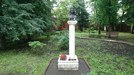
Skver Korolevy Luizy — local attraction, which is located at Ulitsa Turgeneva, 6, Zelenogradsk, Kaliningrad Oblast, 238530 and belongs to the category — park. Average visitor rating for this place — 4.7 (according to 409 ratings, information from open sources and relevant for 2022).
Exact location — Skver Korolevy Luizy, marked on the map with a red marker.
You can get directions to Skver Korolevy Luizy on the map from your location.
What else is interesting in Zelenogradsk? You can see all the sights if you go to the city page.
Coordinates
Skver Korolevy Luizy, Russian Federation coordinates in decimal format: latitude — 54.959419541325985, longitude — 20.475077398424833. When converted to degrees, minutes, seconds Skver Korolevy Luizy has the following coordinates: 54°57′33.91 north latitude and 20°28′30.28 east longitude.
Nearby cities
The largest cities that are located nearby:
- Kaliningrad — 27 km
- Klaipėda
 (Lithuania) — 93 km
 - Elblag
 (Poland) — 112 km
 - Olsztyn (Poland) — 130 km
- Gdynia (Poland) — 134 km
- Gdańsk (Poland) — 135 km
- Šiauliai (Lithuania) — 206 km
- Kaunas (Lithuania) — 218 km
- Torun (Poland) — 248 km
- Panevėžys (Lithuania) — 257 km
- Bydgoszcz (Poland) — 260 km
- Bialystok (Poland) — 269 km
- Plock (Poland) — 271 km
- Wloclawek (Poland) — 272 km
- Koszalin (Poland) — 291 km
- Warsaw (Poland) — 304 km
- Vilnius (Lithuania) — 309 km
- Rīga
 (Latvia) — 311 km
 - Łódź (Poland) — 360 km
Distance to the capital
Distance to the capital (Moscow) is about — 1085 km.