
 Mikhaylovka
Dyrestuy
Mikhaylovka
Mayskiy
Novobessergenevka
Tersky District
Lesnoy
Tertezh
Kuz'minskiye Otverzhki
Mikhaylovka
Dyrestuy
Mikhaylovka
Mayskiy
Novobessergenevka
Tersky District
Lesnoy
Tertezh
Kuz'minskiye Otverzhki
Dacha Funka Istoricheskiy Muzey on the map, Sudak, Crimea
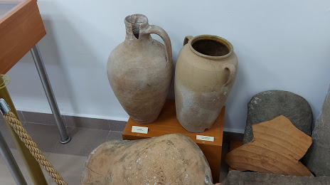
Photo
Where is located Dacha Funka Istoricheskiy Muzey
Dacha Funka Istoricheskiy Muzey — local attraction, which is located at Sudak and belongs to the category — museum. Average visitor rating for this place — 5.0 (according to 1 rating, information from open sources and relevant for 2022).
Exact location — Dacha Funka Istoricheskiy Muzey, marked on the map with a red marker.
You can get directions to Dacha Funka Istoricheskiy Muzey on the map from your location.
What else is interesting in Sudak? You can see all the sights if you go to the city page.
Coordinates
Dacha Funka Istoricheskiy Muzey coordinates in decimal format: latitude — 44.84214355104948, longitude — 34.9648441980617. When converted to degrees, minutes, seconds Dacha Funka Istoricheskiy Muzey has the following coordinates: 44°50′31.72 north latitude and 34°57′53.44 east longitude.
Nearby cities
The largest cities that are located nearby:
- Simferopol — 69 km
- Sevastopol — 117 km
- Kerch — 129 km
- Yevpatoriya — 131 km
- Novorossiysk — 218 km
- Melitopol'
 — 221 km
 - Berdyans'k — 252 km
- Kherson — 267 km
- Nikopol'
 (Ukraine) — 304 km
 - Krasnodar — 312 km
- Kryvyi Rih (Ukraine) — 358 km
- Odessa (Ukraine) — 371 km
- Taganrog — 395 km
- Maykop — 403 km
- Sochi — 405 km
- Dniprodzerzhyns'k (Ukraine) — 407 km
- Donetsk — 408 km
- Samsun
 (Turkey) — 409 km
 - Pavlohrad (Ukraine) — 411 km
Distance to the capital
Distance to the capital (Moscow) is about — 1228 km.