
 Mikhaylovka
Dyrestuy
Mikhaylovka
Mayskiy
Novobessergenevka
Tersky District
Lesnoy
Tertezh
Kuz'minskiye Otverzhki
Mikhaylovka
Dyrestuy
Mikhaylovka
Mayskiy
Novobessergenevka
Tersky District
Lesnoy
Tertezh
Kuz'minskiye Otverzhki
Il'menskoye Ozero on the map, Chebarkul', Russian Federation
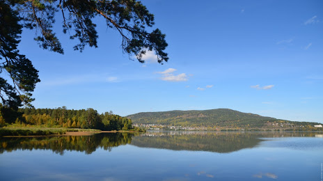
Photo
Where is located Il'menskoye Ozero
Il'menskoye Ozero — local attraction, which is located at 331 m and belongs to the category — -. Average visitor rating for this place — 4.8 (according to 50 ratings, information from open sources and relevant for 2022).
Exact location — Il'menskoye Ozero, marked on the map with a red marker.
You can get directions to Il'menskoye Ozero on the map from your location.
What else is interesting in Chebarkul'? You can see all the sights if you go to the city page.
Coordinates
Il'menskoye Ozero, Russian Federation coordinates in decimal format: latitude — 55.00646368910729, longitude — 60.14585230129011. When converted to degrees, minutes, seconds Il'menskoye Ozero has the following coordinates: 55°0′23.27 north latitude and 60°8′45.07 east longitude.
Nearby cities
The largest cities that are located nearby:
- Miass — 18 km
- Zlatoust — 50 km
- Chelyabinsk — 69 km
- Magnitogorsk — 196 km
- Yekaterinburg — 206 km
- Pervouralsk — 216 km
- Ufa — 283 km
- Kostanay
 (Kazakhstan) — 290 km
 - Kurgan — 316 km
- Sterlitamak — 327 km
- Salavat — 344 km
- Tyumen — 391 km
- Neftekamsk — 396 km
- Perm — 410 km
- Sarapul — 435 km
- Orsk — 437 km
- Novotroitsk — 442 km
- Izhevsk — 481 km
- Orenburg — 507 km
Distance to the capital
Distance to the capital (Moscow) is about — 1420 km.