
 Mikhaylovka
Dyrestuy
Mikhaylovka
Mayskiy
Novobessergenevka
Tersky District
Lesnoy
Tertezh
Kuz'minskiye Otverzhki
Mikhaylovka
Dyrestuy
Mikhaylovka
Mayskiy
Novobessergenevka
Tersky District
Lesnoy
Tertezh
Kuz'minskiye Otverzhki
Vodyanskoe settlement on the map, Dubovka, Russian Federation
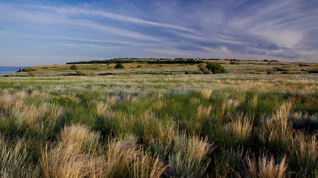
Photo
Where is located Vodyanskoe settlement
Vodyanskoe settlement — local attraction, which is located at Volgograd Oblast, 404002 and belongs to the category — tourist attraction. Average visitor rating for this place — 4.6 (according to 16 ratings, information from open sources and relevant for 2022).
Exact location — Vodyanskoe settlement, marked on the map with a red marker.
You can get directions to Vodyanskoe settlement on the map from your location.
What else is interesting in Dubovka? You can see all the sights if you go to the city page.
Coordinates
Vodyanskoe settlement, Russian Federation coordinates in decimal format: latitude — 49.076252736813444, longitude — 44.849861898207. When converted to degrees, minutes, seconds Vodyanskoe settlement has the following coordinates: 49°4′34.51 north latitude and 44°50′59.5 east longitude.
Nearby cities
The largest cities that are located nearby:
- Volzhskiy — 28 km
- Volgograd — 45 km
- Kamyshin — 121 km
- Volgodonsk — 262 km
- Engels — 285 km
- Saratov — 286 km
- Elista — 305 km
- Shakhty — 373 km
- Balakovo — 386 km
- Astrakhan — 386 km
- Novocherkassk — 399 km
- Luhansk
 — 408 km
 - Bataysk — 438 km
- Alchevs'k — 447 km
- Penza — 459 km
- Tambov — 465 km
- Voronezh — 483 km
- Taganrog — 488 km
- Stavropol — 495 km
Distance to the capital
Distance to the capital (Moscow) is about — 889 km.