
 Mikhaylovka
Dyrestuy
Mikhaylovka
Mayskiy
Novobessergenevka
Tersky District
Lesnoy
Tertezh
Kuz'minskiye Otverzhki
Mikhaylovka
Dyrestuy
Mikhaylovka
Mayskiy
Novobessergenevka
Tersky District
Lesnoy
Tertezh
Kuz'minskiye Otverzhki
Gorodskoy Istoriko-Krayevedcheskiy Muzey on the map, Tikhoretsk, Russian Federation
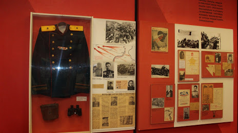
Photo
Where is located Gorodskoy Istoriko-Krayevedcheskiy Muzey
Gorodskoy Istoriko-Krayevedcheskiy Muzey — local attraction, which is located at Ulitsa Kirova, д. 19, Tikhoretsk, Krasnodar Krai, 352100 and belongs to the category — museum. Average visitor rating for this place — 4.4 (according to 8 ratings, information from open sources and relevant for 2022).
Exact location — Gorodskoy Istoriko-Krayevedcheskiy Muzey, marked on the map with a red marker.
You can get directions to Gorodskoy Istoriko-Krayevedcheskiy Muzey on the map from your location.
What else is interesting in Tikhoretsk? You can see all the sights if you go to the city page.
Coordinates
Gorodskoy Istoriko-Krayevedcheskiy Muzey, Russian Federation coordinates in decimal format: latitude — 45.8515516148878, longitude — 40.11600059793701. When converted to degrees, minutes, seconds Gorodskoy Istoriko-Krayevedcheskiy Muzey has the following coordinates: 45°51′5.59 north latitude and 40°6′57.6 east longitude.
Nearby cities
The largest cities that are located nearby:
- Krasnodar — 130 km
- Maykop — 140 km
- Bataysk — 144 km
- Stavropol — 170 km
- Novocherkassk — 171 km
- Taganrog — 175 km
- Nevinnomyssk — 197 km
- Shakhty — 203 km
- Novorossiysk — 226 km
- Volgodonsk — 237 km
- Cherkessk — 237 km
- Sochi — 254 km
- Berdyans'k
 — 272 km
 - Kerch — 290 km
- Donetsk — 294 km
- Kislovodsk — 298 km
- Alchevs'k — 305 km
- Luhansk — 305 km
- Pyatigorsk — 307 km
Distance to the capital
Distance to the capital (Moscow) is about — 1115 km.