
 Mikhaylovka
Dyrestuy
Mikhaylovka
Mayskiy
Novobessergenevka
Tersky District
Lesnoy
Tertezh
Kuz'minskiye Otverzhki
Mikhaylovka
Dyrestuy
Mikhaylovka
Mayskiy
Novobessergenevka
Tersky District
Lesnoy
Tertezh
Kuz'minskiye Otverzhki
Nilo-Stolobenskaya Pustyn' on the map, Ostashkov, Russian Federation
Photo
Where is located Nilo-Stolobenskaya Pustyn'
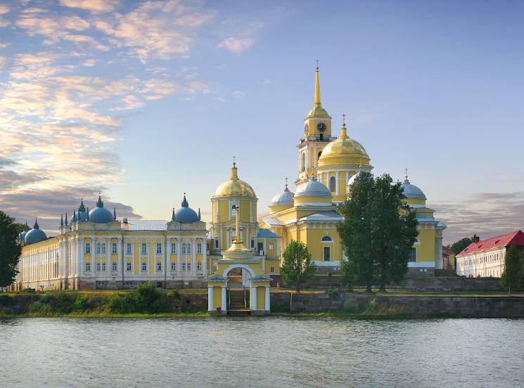
Nilo-Stolobenskaya Pustyn' — local attraction, which is located at д.27 д, Svetlitsa, Tver Oblast, 172757 and belongs to the category — island. Average visitor rating for this place — 4.8 (according to 2150 ratings, information from open sources and relevant for 2022).
Exact location — Nilo-Stolobenskaya Pustyn', marked on the map with a red marker.
You can get directions to Nilo-Stolobenskaya Pustyn' on the map from your location.
What else is interesting in Ostashkov? You can see all the sights if you go to the city page.
Coordinates
Nilo-Stolobenskaya Pustyn', Russian Federation coordinates in decimal format: latitude — 57.23540504936397, longitude — 33.06289309835508. When converted to degrees, minutes, seconds Nilo-Stolobenskaya Pustyn' has the following coordinates: 57°14′7.46 north latitude and 33°3′46.42 east longitude.
Nearby cities
The largest cities that are located nearby:
- Tver — 171 km
- Velikiye Luki — 182 km
- Smolensk — 269 km
- Zelenograd — 281 km
- Pskov — 292 km
- Khimki — 301 km
- Odintsovo — 305 km
- Obninsk — 313 km
- Pushkino — 317 km
- Kolpino — 319 km
- Izmaylovo — 332 km
- Balashikha — 334 km
- Podolsk — 335 km
- Navapolatsk
 (Belarus) — 338 km
 - Lyubertsy — 338 km
- Saint Petersburg — 345 km
- Rybinsk — 349 km
- Cherepovets — 349 km
- Kaluga — 351 km
Distance to the capital
Distance to the capital (Moscow) is about — 324 km.