
 Mikhaylovka
Dyrestuy
Mikhaylovka
Mayskiy
Novobessergenevka
Tersky District
Lesnoy
Tertezh
Kuz'minskiye Otverzhki
Mikhaylovka
Dyrestuy
Mikhaylovka
Mayskiy
Novobessergenevka
Tersky District
Lesnoy
Tertezh
Kuz'minskiye Otverzhki
Fgbu "Natsional'nyy Park "Shushenskiy Bor" on the map, Shushenskoye, Russian Federation
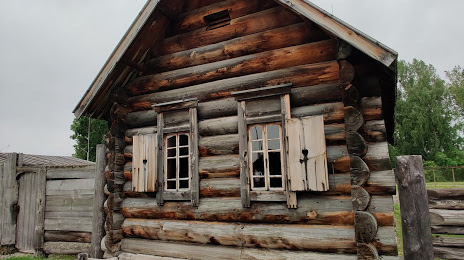
Photo
Where is located Fgbu "Natsional'nyy Park "Shushenskiy Bor"
Fgbu "Natsional'nyy Park "Shushenskiy Bor" — local attraction, which is located at Lugovaya Ulitsa, 9, Shushenskoe, Krasnoyarsk Krai, 662710 and belongs to the category — national park. Average visitor rating for this place — 4.6 (according to 53 ratings, information from open sources and relevant for 2022).
Exact location — Fgbu "Natsional'nyy Park "Shushenskiy Bor", marked on the map with a red marker.
You can get directions to Fgbu "Natsional'nyy Park "Shushenskiy Bor" on the map from your location.
What else is interesting in Shushenskoye? You can see all the sights if you go to the city page.
Coordinates
Fgbu "Natsional'nyy Park "Shushenskiy Bor", Russian Federation coordinates in decimal format: latitude — 53.33677554849176, longitude — 91.93492679820463. When converted to degrees, minutes, seconds Fgbu "Natsional'nyy Park "Shushenskiy Bor" has the following coordinates: 53°20′12.39 north latitude and 91°56′5.74 east longitude.
Nearby cities
The largest cities that are located nearby:
- Abakan — 55 km
- Kyzyl — 247 km
- Mezhdurechensk — 258 km
- Krasnoyarsk — 303 km
- Novokuznetsk — 319 km
- Achinsk — 335 km
- Prokopyevsk — 346 km
- Kansk — 394 km
- Leninsk-Kuznetskiy — 398 km
- Biysk — 461 km
- Barnaul — 539 km
- Tomsk — 551 km
- Seversk — 563 km
- Novosibirsk — 601 km
- Altay
 (China) — 668 km
 - Bratsk — 671 km
- Oskemen
 (Kazakhstan) — 761 km
 - Rubtsovsk — 766 km
- Angarsk — 809 km
Distance to the capital
Distance to the capital (Moscow) is about — 3424 km.