
 Mikhaylovka
Dyrestuy
Mikhaylovka
Mayskiy
Novobessergenevka
Tersky District
Lesnoy
Tertezh
Kuz'minskiye Otverzhki
Mikhaylovka
Dyrestuy
Mikhaylovka
Mayskiy
Novobessergenevka
Tersky District
Lesnoy
Tertezh
Kuz'minskiye Otverzhki
Zvonnitsa Na Prokhorovskom Pole on the map, Prokhorovka, Russian Federation
Photo
Where is located Zvonnitsa Na Prokhorovskom Pole
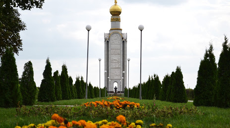
Zvonnitsa Na Prokhorovskom Pole — local attraction, which is located at Prokhorovka, Belgorod Oblast, 309000 and belongs to the category — historical landmark. Average visitor rating for this place — 4.9 (according to 174 ratings, information from open sources and relevant for 2022).
Exact location — Zvonnitsa Na Prokhorovskom Pole, marked on the map with a red marker.
You can get directions to Zvonnitsa Na Prokhorovskom Pole on the map from your location.
What else is interesting in Prokhorovka? You can see all the sights if you go to the city page.
Coordinates
Zvonnitsa Na Prokhorovskom Pole, Russian Federation coordinates in decimal format: latitude — 51.01773643310097, longitude — 36.67141179811859. When converted to degrees, minutes, seconds Zvonnitsa Na Prokhorovskom Pole has the following coordinates: 51°1′3.85 north latitude and 36°40′17.08 east longitude.
Nearby cities
The largest cities that are located nearby:
- Belgorod — 49 km
- Kursk — 84 km
- Sumy
 (Ukraine) — 136 km
 - Voronezh — 184 km
- Yelets — 211 km
- Poltava (Ukraine) — 224 km
- Lipetsk — 259 km
- Pavlohrad (Ukraine) — 286 km
- Bryansk — 290 km
- Horlivka
 — 316 km
 - Dniprodzerzhyns'k (Ukraine) — 318 km
- Alchevs'k — 321 km
- Kremenchuk (Ukraine) — 325 km
- Luhansk — 331 km
- Donetsk — 343 km
- Novomoskovsk — 344 km
- Tula — 355 km
- Tambov — 365 km
- Chernihiv (Ukraine) — 378 km
Distance to the capital
Distance to the capital (Moscow) is about — 531 km.