
 Mikhaylovka
Dyrestuy
Mikhaylovka
Mayskiy
Novobessergenevka
Tersky District
Lesnoy
Tertezh
Kuz'minskiye Otverzhki
Mikhaylovka
Dyrestuy
Mikhaylovka
Mayskiy
Novobessergenevka
Tersky District
Lesnoy
Tertezh
Kuz'minskiye Otverzhki
Dorogobuzhskiy Rayonnyy Istoriko-Krayevedcheskiy Muzey on the map, Dorogobuzh, Russian Federation
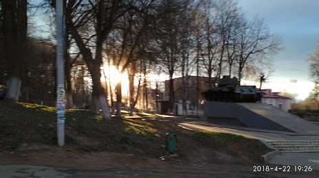
Photo
Where is located Dorogobuzhskiy Rayonnyy Istoriko-Krayevedcheskiy Muzey
Dorogobuzhskiy Rayonnyy Istoriko-Krayevedcheskiy Muzey — local attraction, which is located at 9, ул. Пушкина, г. Дорогобуж, Смоленская обл., Россия 215710, Dorogobuzh, Smolensk Oblast, 215710 and belongs to the category — museum. Average visitor rating for this place — 5.0 (according to 2 ratings, information from open sources and relevant for 2022).
Exact location — Dorogobuzhskiy Rayonnyy Istoriko-Krayevedcheskiy Muzey, marked on the map with a red marker.
You can get directions to Dorogobuzhskiy Rayonnyy Istoriko-Krayevedcheskiy Muzey on the map from your location.
What else is interesting in Dorogobuzh? You can see all the sights if you go to the city page.
Coordinates
Dorogobuzhskiy Rayonnyy Istoriko-Krayevedcheskiy Muzey, Russian Federation coordinates in decimal format: latitude — 54.916168336675874, longitude — 33.29999960334358. When converted to degrees, minutes, seconds Dorogobuzhskiy Rayonnyy Istoriko-Krayevedcheskiy Muzey has the following coordinates: 54°54′58.21 north latitude and 33°17′60 east longitude.
Nearby cities
The largest cities that are located nearby:
- Smolensk — 81 km
- Kaluga — 196 km
- Bryansk — 197 km
- Obninsk — 210 km
- Velikiye Luki — 231 km
- Odintsovo — 261 km
- Serpukhov — 262 km
- Tver — 267 km
- Zelenograd — 269 km
- Podolsk — 272 km
- Khimki — 279 km
- Izmaylovo — 281 km
- Tula — 290 km
- Lyubertsy — 299 km
- Navapolatsk
 (Belarus) — 304 km
 - Pushkino — 305 km
- Balashikha — 307 km
- Gomel (Belarus) — 315 km
- Babruysk (Belarus) — 334 km
Distance to the capital
Distance to the capital (Moscow) is about — 289 km.