
 Mikhaylovka
Dyrestuy
Mikhaylovka
Mayskiy
Novobessergenevka
Tersky District
Lesnoy
Tertezh
Kuz'minskiye Otverzhki
Mikhaylovka
Dyrestuy
Mikhaylovka
Mayskiy
Novobessergenevka
Tersky District
Lesnoy
Tertezh
Kuz'minskiye Otverzhki
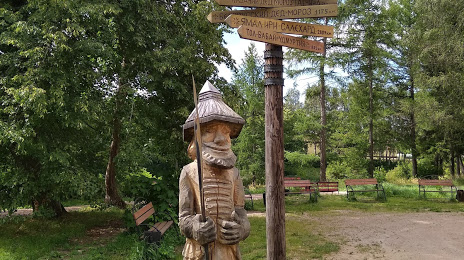
Olonets National Museum Livvi-Karelians of N.G. Prilukina on the map, Olonets, Russian Federation
Photo
Where is located Olonets National Museum Livvi-Karelians of N.G. Prilukina
Olonets National Museum Livvi-Karelians of N.G. Prilukina — local attraction, which is located at Ulitsa 30-Letiya Pobedy, 8, Olonets, Republic of Karelia, 186000 and belongs to the category — museum. Average visitor rating for this place — 4.7 (according to 288 ratings, information from open sources and relevant for 2022).
Exact location — Olonets National Museum Livvi-Karelians of N.G. Prilukina, marked on the map with a red marker.
You can get directions to Olonets National Museum Livvi-Karelians of N.G. Prilukina on the map from your location.
What else is interesting in Olonets? You can see all the sights if you go to the city page.
Coordinates
Olonets National Museum Livvi-Karelians of N.G. Prilukina, Russian Federation coordinates in decimal format: latitude — 60.97843165740244, longitude — 32.96376679850608. When converted to degrees, minutes, seconds Olonets National Museum Livvi-Karelians of N.G. Prilukina has the following coordinates: 60°58′42.35 north latitude and 32°57′49.56 east longitude.
Nearby cities
The largest cities that are located nearby:
- Petrozavodsk — 114 km
- Saint Petersburg — 186 km
- Kolpino — 191 km
- Cherepovets — 347 km
- Vologda — 438 km
- Vantaa
 (Finland) — 441 km
 - Pskov — 444 km
- Helsinki (Finland) — 451 km
- Tartu
 (Estonia) — 462 km
 - Espoo (Finland) — 465 km
- Rybinsk — 472 km
- Tver — 489 km
- Tampere (Finland) — 489 km
- Tallinn (Estonia) — 493 km
- Severodvinsk — 514 km
- Arkhangelsk — 534 km
- Velikiye Luki — 534 km
- Yaroslavl — 552 km
- Oulu (Finland) — 567 km
Distance to the capital
Distance to the capital (Moscow) is about — 641 km.