
 Mikhaylovka
Dyrestuy
Mikhaylovka
Mayskiy
Novobessergenevka
Tersky District
Lesnoy
Tertezh
Kuz'minskiye Otverzhki
Mikhaylovka
Dyrestuy
Mikhaylovka
Mayskiy
Novobessergenevka
Tersky District
Lesnoy
Tertezh
Kuz'minskiye Otverzhki
Gora Kopeyka on the map, Pokhvistnevo, Russian Federation
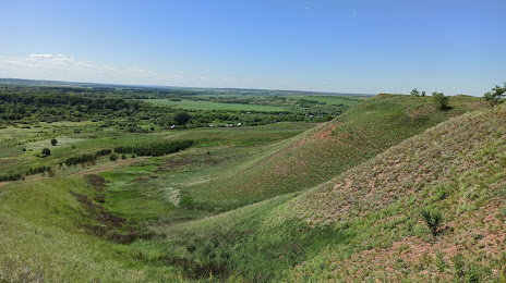
Photo
Where is located Gora Kopeyka
Gora Kopeyka — local attraction, which is located at Samara Oblast, 446450 and belongs to the category — wildlife refuge. Average visitor rating for this place — 4.7 (according to 6 ratings, information from open sources and relevant for 2022).
Exact location — Gora Kopeyka, marked on the map with a red marker.
You can get directions to Gora Kopeyka on the map from your location.
What else is interesting in Pokhvistnevo? You can see all the sights if you go to the city page.
Coordinates
Gora Kopeyka, Russian Federation coordinates in decimal format: latitude — 53.68021320707271, longitude — 52.17253869821763. When converted to degrees, minutes, seconds Gora Kopeyka has the following coordinates: 53°40′48.77 north latitude and 52°10′21.14 east longitude.
Nearby cities
The largest cities that are located nearby:
- Almetyevsk — 138 km
- Samara — 141 km
- Novokuybyshevsk — 158 km
- Dimitrovgrad — 178 km
- Tolyatti — 179 km
- Nizhnekamsk — 220 km
- Syzran — 249 km
- Sterlitamak — 250 km
- Salavat — 253 km
- Ulyanovsk — 254 km
- Ufa — 273 km
- Orenburg — 291 km
- Kazan — 301 km
- Neftekamsk — 302 km
- Sarapul — 328 km
- Zelenodolsk — 331 km
- Balakovo — 346 km
- Izhevsk — 358 km
- Novocheboksarsk — 394 km
Distance to the capital
Distance to the capital (Moscow) is about — 961 km.