
 Mikhaylovka
Dyrestuy
Mikhaylovka
Mayskiy
Novobessergenevka
Tersky District
Lesnoy
Tertezh
Kuz'minskiye Otverzhki
Mikhaylovka
Dyrestuy
Mikhaylovka
Mayskiy
Novobessergenevka
Tersky District
Lesnoy
Tertezh
Kuz'minskiye Otverzhki
Sudakovskoye on the map, Priozersk, Russian Federation
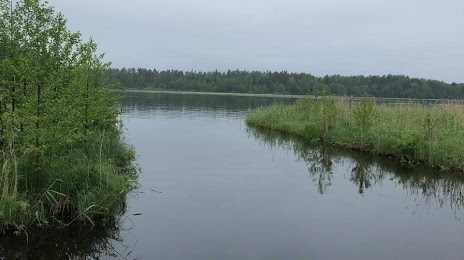
Photo
Where is located Sudakovskoye
Sudakovskoye — local attraction, which is located at 9 m and belongs to the category — -. Average visitor rating for this place — 5.0 (according to 1 rating, information from open sources and relevant for 2022).
Exact location — Sudakovskoye, marked on the map with a red marker.
You can get directions to Sudakovskoye on the map from your location.
What else is interesting in Priozersk? You can see all the sights if you go to the city page.
Coordinates
Sudakovskoye, Russian Federation coordinates in decimal format: latitude — 60.993957268783305, longitude — 30.142777915353623. When converted to degrees, minutes, seconds Sudakovskoye has the following coordinates: 60°59′38.25 north latitude and 30°8′34 east longitude.
Nearby cities
The largest cities that are located nearby:
- Saint Petersburg — 123 km
- Kolpino — 147 km
- Petrozavodsk — 234 km
- Vantaa
 (Finland) — 291 km
 - Helsinki (Finland) — 301 km
- Espoo (Finland) — 315 km
- Tampere (Finland) — 340 km
- Tallinn
 (Estonia) — 351 km
 - Tartu (Estonia) — 354 km
- Pskov — 372 km
- Turku (Finland) — 434 km
- Cherepovets — 489 km
- Oulu (Finland) — 490 km
- Velikiye Luki — 520 km
- Tver — 580 km
- Rīga
 (Latvia) — 580 km
 - Vologda — 588 km
- Severodvinsk — 605 km
- Rybinsk — 607 km
Distance to the capital
Distance to the capital (Moscow) is about — 727 km.