
 Mikhaylovka
Dyrestuy
Mikhaylovka
Mayskiy
Novobessergenevka
Tersky District
Lesnoy
Tertezh
Kuz'minskiye Otverzhki
Mikhaylovka
Dyrestuy
Mikhaylovka
Mayskiy
Novobessergenevka
Tersky District
Lesnoy
Tertezh
Kuz'minskiye Otverzhki
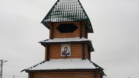
Kazan Aleksieva Sergius desert on the map, Serdobsk, Russian Federation
Photo
Where is located Kazan Aleksieva Sergius desert
Kazan Aleksieva Sergius desert — local attraction, which is located at пос. Сазанье, Penza Oblast, 442882 and belongs to the category — shrine. Average visitor rating for this place — 4.7 (according to 28 ratings, information from open sources and relevant for 2022).
Exact location — Kazan Aleksieva Sergius desert, marked on the map with a red marker.
You can get directions to Kazan Aleksieva Sergius desert on the map from your location.
What else is interesting in Serdobsk? You can see all the sights if you go to the city page.
Coordinates
Kazan Aleksieva Sergius desert, Russian Federation coordinates in decimal format: latitude — 52.50496762700632, longitude — 44.16058489817349. When converted to degrees, minutes, seconds Kazan Aleksieva Sergius desert has the following coordinates: 52°30′17.88 north latitude and 44°9′38.11 east longitude.
Nearby cities
The largest cities that are located nearby:
- Penza — 97 km
- Saratov — 161 km
- Engels — 169 km
- Tambov — 188 km
- Saransk — 200 km
- Balakovo — 247 km
- Kamyshin — 277 km
- Syzran — 292 km
- Lipetsk — 310 km
- Arzamas — 325 km
- Ulyanovsk — 337 km
- Voronezh — 354 km
- Tolyatti — 361 km
- Murom — 369 km
- Ryazan — 373 km
- Yelets — 384 km
- Novokuybyshevsk — 386 km
- Dimitrovgrad — 397 km
- Samara — 401 km
Distance to the capital
Distance to the capital (Moscow) is about — 559 km.