
 Mikhaylovka
Dyrestuy
Mikhaylovka
Mayskiy
Novobessergenevka
Tersky District
Lesnoy
Tertezh
Kuz'minskiye Otverzhki
Mikhaylovka
Dyrestuy
Mikhaylovka
Mayskiy
Novobessergenevka
Tersky District
Lesnoy
Tertezh
Kuz'minskiye Otverzhki
Toplyy Klyuch on the map, Yarovoye, Russian Federation
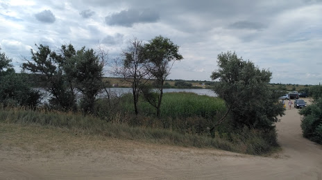
Photo
Where is located Toplyy Klyuch
Toplyy Klyuch — local attraction, which is located at Unnamed Road, Yarovoye, Altai Krai, 658837 and belongs to the category — hiking area. Average visitor rating for this place — 4.2 (according to 461 rating, information from open sources and relevant for 2022).
Exact location — Toplyy Klyuch, marked on the map with a red marker.
You can get directions to Toplyy Klyuch on the map from your location.
What else is interesting in Yarovoye? You can see all the sights if you go to the city page.
Coordinates
Toplyy Klyuch, Russian Federation coordinates in decimal format: latitude — 52.861164592301996, longitude — 78.55000929818672. When converted to degrees, minutes, seconds Toplyy Klyuch has the following coordinates: 52°51′40.19 north latitude and 78°33′0.03 east longitude.
Nearby cities
The largest cities that are located nearby:
- Pavlodar
 (Kazakhstan) — 131 km
 - Rubtsovsk — 239 km
- Ekibastuz (Kazakhstan) — 261 km
- Semey (Kazakhstan) — 301 km
- Barnaul — 345 km
- Novosibirsk — 359 km
- Omsk — 401 km
- Oskemen (Kazakhstan) — 434 km
- Biysk — 448 km
- Temirtau (Kazakhstan) — 510 km
- Leninsk-Kuznetskiy — 521 km
- Prokopyevsk — 540 km
- Tomsk — 555 km
- Seversk — 557 km
- Novokuznetsk — 566 km
- Kokshetau (Kazakhstan) — 608 km
- Mezhdurechensk — 625 km
- Achinsk — 819 km
- Abakan — 844 km
Distance to the capital
Distance to the capital (Moscow) is about — 2636 km.