
 Mikhaylovka
Dyrestuy
Mikhaylovka
Mayskiy
Novobessergenevka
Tersky District
Lesnoy
Tertezh
Kuz'minskiye Otverzhki
Mikhaylovka
Dyrestuy
Mikhaylovka
Mayskiy
Novobessergenevka
Tersky District
Lesnoy
Tertezh
Kuz'minskiye Otverzhki
Plyazh Krasnoglinskiy on the map, Samara, Russian Federation
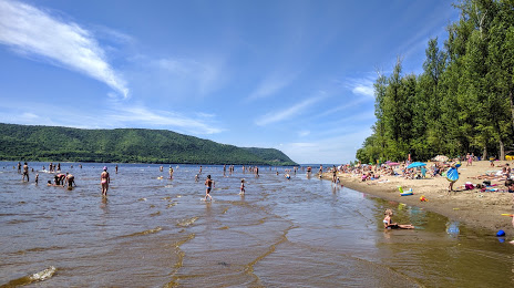
Photo
Where is located Plyazh Krasnoglinskiy
Plyazh Krasnoglinskiy — local attraction, which is located at no data and belongs to the category — -. Average visitor rating for this place — 4.3 (according to 853 ratings, information from open sources and relevant for 2022).
Exact location — Plyazh Krasnoglinskiy, marked on the map with a red marker.
You can get directions to Plyazh Krasnoglinskiy on the map from your location.
What else is interesting in Samara? You can see all the sights if you go to the city page.
Coordinates
Plyazh Krasnoglinskiy, Russian Federation coordinates in decimal format: latitude — 53.38177133834107, longitude — 50.15513019604504. When converted to degrees, minutes, seconds Plyazh Krasnoglinskiy has the following coordinates: 53°22′54.38 north latitude and 50°9′18.47 east longitude.
Nearby cities
The largest cities that are located nearby:
- Novokuybyshevsk — 18 km
- Tolyatti — 58 km
- Syzran — 111 km
- Dimitrovgrad — 119 km
- Ulyanovsk — 168 km
- Balakovo — 206 km
- Almetyevsk — 233 km
- Nizhnekamsk — 288 km
- Kazan — 293 km
- Zelenodolsk — 310 km
- Engels — 335 km
- Saratov — 338 km
- Saransk — 339 km
- Penza — 339 km
- Novocheboksarsk — 360 km
- Cheboksary — 372 km
- Orenburg — 375 km
- Salavat — 383 km
- Sterlitamak — 384 km
Distance to the capital
Distance to the capital (Moscow) is about — 849 km.