
 Mikhaylovka
Dyrestuy
Mikhaylovka
Mayskiy
Novobessergenevka
Tersky District
Lesnoy
Tertezh
Kuz'minskiye Otverzhki
Mikhaylovka
Dyrestuy
Mikhaylovka
Mayskiy
Novobessergenevka
Tersky District
Lesnoy
Tertezh
Kuz'minskiye Otverzhki
Dolina Uyuta on the map, Murmansk, Russian Federation
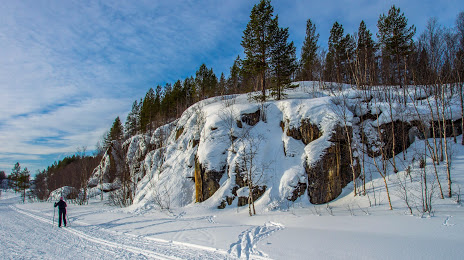
Photo
Where is located Dolina Uyuta
Dolina Uyuta — local attraction, which is located at Ulitsa Dolina Uyuta, 3, Murmansk, Murmansk Oblast, 183008 and belongs to the category — sports complex. Average visitor rating for this place — 4.7 (according to 804 ratings, information from open sources and relevant for 2022).
Exact location — Dolina Uyuta, marked on the map with a red marker.
You can get directions to Dolina Uyuta on the map from your location.
What else is interesting in Murmansk? You can see all the sights if you go to the city page.
Coordinates
Dolina Uyuta, Russian Federation coordinates in decimal format: latitude — 68.94146291048006, longitude — 33.128988098844616. When converted to degrees, minutes, seconds Dolina Uyuta has the following coordinates: 68°56′29.27 north latitude and 33°7′44.36 east longitude.
Nearby cities
The largest cities that are located nearby:
- Oulu
 (Finland) — 563 km
 - Severodvinsk — 583 km
- Arkhangelsk — 603 km
- Petrozavodsk — 796 km
- Tampere (Finland) — 960 km
- Saint Petersburg — 1009 km
- Kolpino — 1029 km
- Vantaa (Finland) — 1055 km
- Helsinki (Finland) — 1070 km
- Espoo (Finland) — 1073 km
- Turku (Finland) — 1110 km
- Cherepovets — 1120 km
- Vologda — 1144 km
- Tallinn
 (Estonia) — 1152 km
 - Ukhta — 1177 km
- Tartu (Estonia) — 1226 km
- Syktyvkar — 1231 km
- Rybinsk — 1252 km
- Pskov — 1263 km
Distance to the capital
Distance to the capital (Moscow) is about — 1484 km.