
 Mikhaylovka
Dyrestuy
Mikhaylovka
Mayskiy
Novobessergenevka
Tersky District
Lesnoy
Tertezh
Kuz'minskiye Otverzhki
Mikhaylovka
Dyrestuy
Mikhaylovka
Mayskiy
Novobessergenevka
Tersky District
Lesnoy
Tertezh
Kuz'minskiye Otverzhki
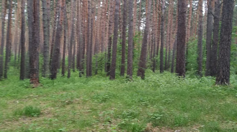
Karakan Pine Forest on the map, Ordynskoye, Russian Federation
Photo
Where is located Karakan Pine Forest
Karakan Pine Forest — local attraction, which is located at no data and belongs to the category — -. Average visitor rating for this place — 4.9 (according to 75 ratings, information from open sources and relevant for 2022).
Exact location — Karakan Pine Forest, marked on the map with a red marker.
You can get directions to Karakan Pine Forest on the map from your location.
What else is interesting in Ordynskoye? You can see all the sights if you go to the city page.
Coordinates
Karakan Pine Forest, Russian Federation coordinates in decimal format: latitude — 54.347723584051344, longitude — 81.87246795545. When converted to degrees, minutes, seconds Karakan Pine Forest has the following coordinates: 54°20′51.8 north latitude and 81°52′20.88 east longitude.
Nearby cities
The largest cities that are located nearby:
- Novosibirsk — 100 km
- Barnaul — 168 km
- Leninsk-Kuznetskiy — 278 km
- Biysk — 303 km
- Tomsk — 306 km
- Seversk — 309 km
- Rubtsovsk — 316 km
- Prokopyevsk — 322 km
- Novokuznetsk — 351 km
- Pavlodar
 (Kazakhstan) — 401 km
 - Mezhdurechensk — 413 km
- Semey (Kazakhstan) — 448 km
- Oskemen (Kazakhstan) — 487 km
- Ekibastuz (Kazakhstan) — 533 km
- Omsk — 542 km
- Achinsk — 572 km
- Abakan — 630 km
- Krasnoyarsk — 707 km
- Nizhnevartovsk — 783 km
Distance to the capital
Distance to the capital (Moscow) is about — 2776 km.