
 Mikhaylovka
Dyrestuy
Mikhaylovka
Mayskiy
Novobessergenevka
Tersky District
Lesnoy
Tertezh
Kuz'minskiye Otverzhki
Mikhaylovka
Dyrestuy
Mikhaylovka
Mayskiy
Novobessergenevka
Tersky District
Lesnoy
Tertezh
Kuz'minskiye Otverzhki
Reka Assa on the map, Achkhoy-Martan, Russian Federation
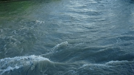
Photo
Where is located Reka Assa
Reka Assa — local attraction, which is located at 133 km and belongs to the category — -. Average visitor rating for this place — 4.8 (according to 42 ratings, information from open sources and relevant for 2022).
Exact location — Reka Assa, marked on the map with a red marker.
You can get directions to Reka Assa on the map from your location.
What else is interesting in Achkhoy-Martan? You can see all the sights if you go to the city page.
Coordinates
Reka Assa, Russian Federation coordinates in decimal format: latitude — 43.25957488998731, longitude — 45.33573082831191. When converted to degrees, minutes, seconds Reka Assa has the following coordinates: 43°15′34.47 north latitude and 45°20′8.63 east longitude.
Nearby cities
The largest cities that are located nearby:
- Nazran — 42 km
- Vladikavkaz — 55 km
- Khasavyurt — 104 km
- Nalchik — 138 km
- Tbilisi
 (Georgia) — 168 km
 - Makhachkala — 180 km
- Pyatigorsk — 202 km
- Kislovodsk — 220 km
- Kutaisi (Georgia) — 236 km
- Vanadzor
 (Armenia) — 271 km
 - Derbent — 277 km
- Cherkessk — 281 km
- Gyumri (Armenia) — 291 km
- Nevinnomyssk — 309 km
- Stavropol — 330 km
- Yerevan (Armenia) — 338 km
- Batumi (Georgia) — 347 km
- Elista — 355 km
- Astrakhan — 409 km
Distance to the capital
Distance to the capital (Moscow) is about — 1495 km.