
 Mikhaylovka
Dyrestuy
Mikhaylovka
Mayskiy
Novobessergenevka
Tersky District
Lesnoy
Tertezh
Kuz'minskiye Otverzhki
Mikhaylovka
Dyrestuy
Mikhaylovka
Mayskiy
Novobessergenevka
Tersky District
Lesnoy
Tertezh
Kuz'minskiye Otverzhki
Gorodskoye Ozero on the map, Zheleznogorsk, Russian Federation
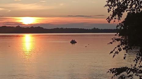
Photo
Where is located Gorodskoye Ozero
Gorodskoye Ozero — local attraction, which is located at no data and belongs to the category — -. Average visitor rating for this place — 4.5 (according to 197 ratings, information from open sources and relevant for 2022).
Exact location — Gorodskoye Ozero, marked on the map with a red marker.
You can get directions to Gorodskoye Ozero on the map from your location.
What else is interesting in Zheleznogorsk? You can see all the sights if you go to the city page.
Coordinates
Gorodskoye Ozero, Russian Federation coordinates in decimal format: latitude — 56.24130913160855, longitude — 93.51557785436901. When converted to degrees, minutes, seconds Gorodskoye Ozero has the following coordinates: 56°14′28.71 north latitude and 93°30′56.08 east longitude.
Nearby cities
The largest cities that are located nearby:
- Krasnoyarsk — 48 km
- Kansk — 134 km
- Achinsk — 186 km
- Abakan — 313 km
- Mezhdurechensk — 458 km
- Bratsk — 497 km
- Novokuznetsk — 502 km
- Leninsk-Kuznetskiy — 503 km
- Kyzyl — 506 km
- Prokopyevsk — 516 km
- Tomsk — 522 km
- Seversk — 530 km
- Ust-Ilimsk — 569 km
- Novosibirsk — 686 km
- Biysk — 694 km
- Barnaul — 720 km
- Angarsk — 808 km
- Rubtsovsk — 997 km
- Altay
 (China) — 1012 km
Distance to the capital
Distance to the capital (Moscow) is about — 3380 km.