
 Bokamoso
Buysdorp
Xihosana
Ga-Sekororo
Ga-Rankuwa
Three Sisters
George
Haenertsburg
Polokwane
Bokamoso
Buysdorp
Xihosana
Ga-Sekororo
Ga-Rankuwa
Three Sisters
George
Haenertsburg
Polokwane
James Hall Museum of Transport on the map, Johannesburg, South Africa
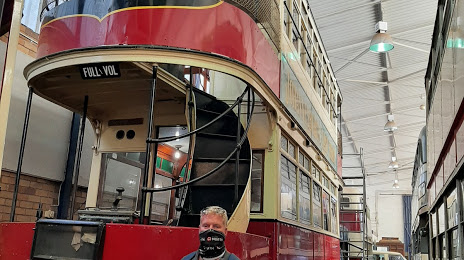
Photo
Where is located James Hall Museum of Transport
James Hall Museum of Transport — local attraction, which is located at Klipriviersberg 106-Ir, Johannesburg South, 2197, South Africa and belongs to the category — museum. Average visitor rating for this place — 4.3 (according to 413 ratings, information from open sources and relevant for 2022).
Exact location — James Hall Museum of Transport, marked on the map with a red marker.
You can get directions to James Hall Museum of Transport on the map from your location.
What else is interesting in Johannesburg? You can see all the sights if you go to the city page.
Coordinates
James Hall Museum of Transport, South Africa coordinates in decimal format: latitude — -26.23355992524716, longitude — 28.05374999755565. When converted to degrees, minutes, seconds James Hall Museum of Transport has the following coordinates: -26°14′0.82 north latitude and 28°3′13.5 east longitude.
Nearby cities
The largest cities that are located nearby:
- Roodepoort — 17 km
- Boksburg — 19 km
- Soweto — 20 km
- Midrand — 24 km
- Benoni — 27 km
- Tembisa — 27 km
- Diepsloot — 29 km
- Krugersdorp — 30 km
- Randfontein — 34 km
- Centurion — 38 km
- Springs — 40 km
- Westonaria — 41 km
- Nigel — 46 km
- Vereeniging — 53 km
- Vanderbijlpark — 59 km
- Carletonville — 67 km
- Brits — 70 km
- Rustenburg — 100 km
- Embalenhle — 109 km
Distance to the capital
Distance to the capital (Pretoria) is about — 56 km.