
Other locations
Tifra  Zelfana
Balloul
أحمد سالم كركرة
Ouargla Province
Boumaiza
Constantine
Frane
Ain Arko
Corso
Zelfana
Balloul
أحمد سالم كركرة
Ouargla Province
Boumaiza
Constantine
Frane
Ain Arko
Corso
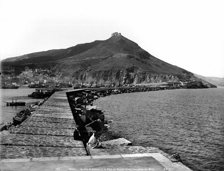
Aïdour on the map, Oran, Algeria
Comments
Where is located Aïdour on the map, Oran, Algeria. Geographic coordinates in decimal format, as well as degrees, minutes and seconds. Photo, address and average rating of visitors who have been here.
Photo
Where is located Aïdour
Aïdour — local attraction, which is located at 429 m and belongs to the category — -. Average visitor rating for this place — 4.2 (according to 23 ratings, information from open sources and relevant for 2022).
Exact location — Aïdour, marked on the map with a red marker.
You can get directions to Aïdour on the map from your location.
What else is interesting in Oran? You can see all the sights if you go to the city page.
Coordinates
Aïdour, Algeria coordinates in decimal format: latitude — 35.703580165025244, longitude — -0.6827781400528604. When converted to degrees, minutes, seconds Aïdour has the following coordinates: 35°42′12.89 north latitude and -0°40′58 east longitude.
Nearby cities
The largest cities that are located nearby:
- Sidi Bel Abbes — 55 km
- Relizane — 106 km
- Tlemcen — 109 km
- Saida — 118 km
- Oujda
 (Morocco) — 161 km
 - Chlef — 183 km
- Almería
 (Spain) — 205 km
 - Cartagena (Spain) — 216 km
- Nador (Morocco) — 216 km
- Murcia (Spain) — 257 km
- Médéa — 308 km
- Granada (Spain) — 308 km
- Algiers — 346 km
- Taza (Morocco) — 350 km
- Málaga (Spain) — 354 km
- Jaén (Spain) — 359 km
- Albacete (Spain) — 379 km
- Laghouat — 384 km
- Taounate (Morocco) — 387 km