 Pointe-à-la-Croix
Sainte-Irène, Quebec
Marsoui
Hecla
Muskrat Dam
Wunnummin Lake
Sainte-Brigitte-de-Laval
Drayton
Mauricie
Pointe-à-la-Croix
Sainte-Irène, Quebec
Marsoui
Hecla
Muskrat Dam
Wunnummin Lake
Sainte-Brigitte-de-Laval
Drayton
Mauricie
Île Saint-Quentin on the map, Trois-Rivières, Canada
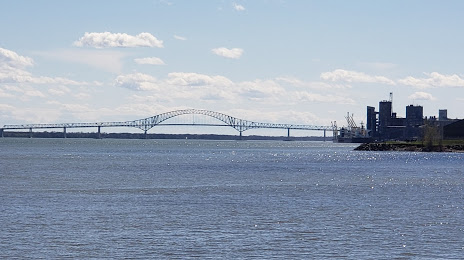
Photo
Where is located Île Saint-Quentin
Île Saint-Quentin — local attraction, which is located at 38 ha and belongs to the category — -. Average visitor rating for this place — 4.4 (according to 124 ratings, information from open sources and relevant for 2022).
Exact location — Île Saint-Quentin, marked on the map with a red marker.
You can get directions to Île Saint-Quentin on the map from your location.
What else is interesting in Trois-Rivières? You can see all the sights if you go to the city page.
Coordinates
Île Saint-Quentin, Canada coordinates in decimal format: latitude — 46.35469148629385, longitude — -72.52300552981228. When converted to degrees, minutes, seconds Île Saint-Quentin has the following coordinates: 46°21′16.89 north latitude and -72°31′22.82 east longitude.
Nearby cities
The largest cities that are located nearby:
- Levis — 108 km
- Quebec — 111 km
- Sherbrooke — 116 km
- Longueuil — 116 km
- Laval — 122 km
- Montreal — 122 km
- Saguenay — 255 km
- Gatineau — 263 km
- Manchester
 (United States) — 380 km
 - Kingston — 390 km
- Lowell (United States) — 422 km
- Amherst (United States) — 443 km
- Cambridge (United States) — 454 km
- Worcester (United States) — 455 km
- Boston (United States) — 457 km
- Syracuse (United States) — 466 km
- Springfield (United States) — 469 km
- Hartford (United States) — 506 km
- Providence (United States) — 508 km
Distance to the capital
Distance to the capital (Ottawa) is about — 267 km.