 Pointe-à-la-Croix
Sainte-Irène, Quebec
Marsoui
Hecla
Muskrat Dam
Wunnummin Lake
Sainte-Brigitte-de-Laval
Drayton
Mauricie
Pointe-à-la-Croix
Sainte-Irène, Quebec
Marsoui
Hecla
Muskrat Dam
Wunnummin Lake
Sainte-Brigitte-de-Laval
Drayton
Mauricie
Plage Lucien-Blanchard on the map, Sherbrooke, Canada
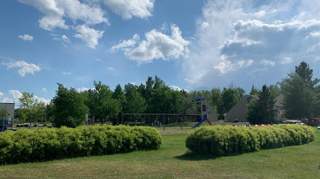
Photo
Where is located Plage Lucien-Blanchard
Plage Lucien-Blanchard — local attraction, which is located at Quebec and belongs to the category — -. Average visitor rating for this place — 4.5 (according to 21 rating, information from open sources and relevant for 2022).
Exact location — Plage Lucien-Blanchard, marked on the map with a red marker.
You can get directions to Plage Lucien-Blanchard on the map from your location.
What else is interesting in Sherbrooke? You can see all the sights if you go to the city page.
Coordinates
Plage Lucien-Blanchard, Canada coordinates in decimal format: latitude — 45.395341826166074, longitude — -71.92734015191986. When converted to degrees, minutes, seconds Plage Lucien-Blanchard has the following coordinates: 45°23′43.23 north latitude and -71°55′38.42 east longitude.
Nearby cities
The largest cities that are located nearby:
- Trois-Rivières — 116 km
- Longueuil — 127 km
- Montreal — 131 km
- Laval — 143 km
- Levis — 155 km
- Quebec — 162 km
- Manchester
 (United States) — 268 km
 - Gatineau — 296 km
- Lowell (United States) — 309 km
- Saguenay — 340 km
- Cambridge (United States) — 341 km
- Amherst (United States) — 342 km
- Boston (United States) — 343 km
- Worcester (United States) — 347 km
- Springfield (United States) — 369 km
- Kingston — 387 km
- Providence (United States) — 397 km
- Hartford (United States) — 408 km
- Syracuse (United States) — 432 km
Distance to the capital
Distance to the capital (Ottawa) is about — 294 km.