 Pointe-à-la-Croix
Sainte-Irène, Quebec
Marsoui
Hecla
Muskrat Dam
Wunnummin Lake
Sainte-Brigitte-de-Laval
Drayton
Mauricie
Pointe-à-la-Croix
Sainte-Irène, Quebec
Marsoui
Hecla
Muskrat Dam
Wunnummin Lake
Sainte-Brigitte-de-Laval
Drayton
Mauricie
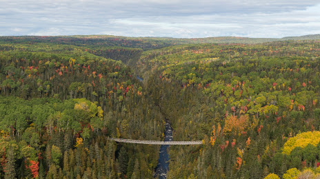
Canyon des Portes de l'Enfer , Terfa on the map, Rimouski, Canada
Photo
Where is located Canyon des Portes de l'Enfer , Terfa
Canyon des Portes de l'Enfer , Terfa — local attraction, which is located at 1280 Chem. Duchénier, Saint-Narcisse-de-Rimouski, QC G0K 1S0, Canada and belongs to the category — hiking area. Average visitor rating for this place — 4.6 (according to 315 ratings, information from open sources and relevant for 2022).
Exact location — Canyon des Portes de l'Enfer , Terfa, marked on the map with a red marker.
You can get directions to Canyon des Portes de l'Enfer , Terfa on the map from your location.
What else is interesting in Rimouski? You can see all the sights if you go to the city page.
Coordinates
Canyon des Portes de l'Enfer , Terfa, Canada coordinates in decimal format: latitude — 48.230895329392496, longitude — -68.50428950182277. When converted to degrees, minutes, seconds Canyon des Portes de l'Enfer , Terfa has the following coordinates: 48°13′51.22 north latitude and -68°30′15.44 east longitude.
Nearby cities
The largest cities that are located nearby:
- Saguenay — 187 km
- Quebec — 269 km
- Levis — 274 km
- Trois-Rivières — 380 km
- Sherbrooke — 420 km
- Longueuil — 498 km
- Montreal — 504 km
- Laval — 505 km
- Dartmouth — 566 km
- Halifax — 566 km
- Manchester
 (United States) — 640 km
 - Gatineau — 642 km
- Lowell (United States) — 674 km
- Cambridge (United States) — 696 km
- Boston (United States) — 696 km
- Worcester (United States) — 727 km
- Amherst (United States) — 742 km
- Providence (United States) — 762 km
- Springfield (United States) — 769 km
Distance to the capital
Distance to the capital (Ottawa) is about — 630 km.