 Pointe-à-la-Croix
Sainte-Irène, Quebec
Marsoui
Hecla
Muskrat Dam
Wunnummin Lake
Sainte-Brigitte-de-Laval
Drayton
Mauricie
Pointe-à-la-Croix
Sainte-Irène, Quebec
Marsoui
Hecla
Muskrat Dam
Wunnummin Lake
Sainte-Brigitte-de-Laval
Drayton
Mauricie
Centre plein air Mont Farlagne on the map, Edmundston, Canada
Photo
Where is located Centre plein air Mont Farlagne
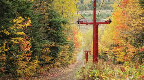
Centre plein air Mont Farlagne — local attraction, which is located at 360 Chem. Mont Farlagne, Saint-Jacques, NB E7B 2X1, Canada and belongs to the category — ski resort. Average visitor rating for this place — 4.6 (according to 131 rating, information from open sources and relevant for 2022).
Exact location — Centre plein air Mont Farlagne, marked on the map with a red marker.
You can get directions to Centre plein air Mont Farlagne on the map from your location.
What else is interesting in Edmundston? You can see all the sights if you go to the city page.
Coordinates
Centre plein air Mont Farlagne, Canada coordinates in decimal format: latitude — 47.41441609188975, longitude — -68.38133700185126. When converted to degrees, minutes, seconds Centre plein air Mont Farlagne has the following coordinates: 47°24′51.9 north latitude and -68°22′52.81 east longitude.
Nearby cities
The largest cities that are located nearby:
- Quebec — 229 km
- Levis — 232 km
- Saguenay — 233 km
- Trois-Rivières — 341 km
- Sherbrooke — 351 km
- Longueuil — 450 km
- Montreal — 456 km
- Laval — 460 km
- Dartmouth — 479 km
- Halifax — 480 km
- Manchester
 (United States) — 546 km
 - Lowell (United States) — 577 km
- Boston (United States) — 597 km
- Cambridge (United States) — 597 km
- Gatineau — 609 km
- Ottawa — 611 km
- Worcester (United States) — 632 km
- Amherst (United States) — 652 km
- Providence (United States) — 664 km
Distance to the capital
Distance to the capital (Washington) is about — 1177 km.