 Pointe-à-la-Croix
Sainte-Irène, Quebec
Marsoui
Hecla
Muskrat Dam
Wunnummin Lake
Sainte-Brigitte-de-Laval
Drayton
Mauricie
Pointe-à-la-Croix
Sainte-Irène, Quebec
Marsoui
Hecla
Muskrat Dam
Wunnummin Lake
Sainte-Brigitte-de-Laval
Drayton
Mauricie
Yukon Beringia Interpretive Centre on the map, Whitehorse, Canada
Photo
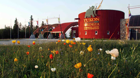
Where is located Yukon Beringia Interpretive Centre
Yukon Beringia Interpretive Centre — local attraction, which is located at Alaska Hwy, Whitehorse, YT Y1A 6E6, Canada and belongs to the category — natural history museum. Average visitor rating for this place — 4.6 (according to 214 ratings, information from open sources and relevant for 2022).
Exact location — Yukon Beringia Interpretive Centre, marked on the map with a red marker.
You can get directions to Yukon Beringia Interpretive Centre on the map from your location.
What else is interesting in Whitehorse? You can see all the sights if you go to the city page.
Coordinates
Yukon Beringia Interpretive Centre, Canada coordinates in decimal format: latitude — 60.70972033193989, longitude — -135.07953800134666. When converted to degrees, minutes, seconds Yukon Beringia Interpretive Centre has the following coordinates: 60°42′34.99 north latitude and -135°4′46.34 east longitude.
Nearby cities
The largest cities that are located nearby:
- Anchorage
 (United States) — 792 km
 - Vancouver — 1530 km
- Anmore — 1537 km
- Burnaby — 1538 km
- Richmond — 1541 km
- Coquitlam — 1543 km
- Surrey — 1551 km
- Delta — 1553 km
- Abbotsford — 1586 km
- Victoria — 1607 km
- Edmonton — 1624 km
- Kelowna — 1632 km
- Seattle (United States) — 1733 km
- Bellevue (United States) — 1738 km
- Tacoma (United States) — 1764 km
- Calgary — 1809 km
- Portland (United States) — 1935 km
- Spokane (United States) — 1952 km
- Salem (United States) — 1982 km
Distance to the capital
Distance to the capital (Ottawa) is about — 4142 km.