 Pointe-à-la-Croix
Sainte-Irène, Quebec
Marsoui
Hecla
Muskrat Dam
Wunnummin Lake
Sainte-Brigitte-de-Laval
Drayton
Mauricie
Pointe-à-la-Croix
Sainte-Irène, Quebec
Marsoui
Hecla
Muskrat Dam
Wunnummin Lake
Sainte-Brigitte-de-Laval
Drayton
Mauricie
The College of Piping and Celtic Performing Arts Centre on the map, Summerside, Canada
Photo
Where is located The College of Piping and Celtic Performing Arts Centre
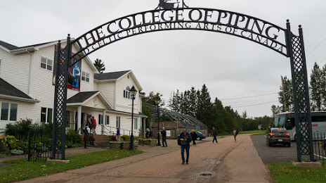
The College of Piping and Celtic Performing Arts Centre — local attraction, which is located at 619 Water St E, Summerside, PE C1N 4H8, Canada and belongs to the category — education center. Average visitor rating for this place — - (according to 15 ratings, information from open sources and relevant for 2022).
Exact location — The College of Piping and Celtic Performing Arts Centre, marked on the map with a red marker.
You can get directions to The College of Piping and Celtic Performing Arts Centre on the map from your location.
What else is interesting in Summerside? You can see all the sights if you go to the city page.
Coordinates
The College of Piping and Celtic Performing Arts Centre, Canada coordinates in decimal format: latitude — 46.39444536924989, longitude — -63.76897420188616. When converted to degrees, minutes, seconds The College of Piping and Celtic Performing Arts Centre has the following coordinates: 46°23′40 north latitude and -63°46′8.31 east longitude.
Nearby cities
The largest cities that are located nearby:
- Dartmouth — 192 km
- Halifax — 194 km
- Quebec — 566 km
- Levis — 566 km
- Saguenay — 579 km
- Sherbrooke — 638 km
- Trois-Rivières — 668 km
- Manchester
 (United States) — 725 km
 - Lowell (United States) — 740 km
- Boston (United States) — 743 km
- Cambridge (United States) — 745 km
- Longueuil — 759 km
- Montreal — 764 km
- Laval — 772 km
- Worcester (United States) — 799 km
- Providence (United States) — 806 km
- Amherst (United States) — 841 km
- Springfield (United States) — 864 km
- Hartford (United States) — 894 km
Distance to the capital
Distance to the capital (Ottawa) is about — 929 km.