
 Gilserberg
Berlin
Bordesholm
Bechtolsheim
Aub
Triptis
Heppenheim
Biblis
Angermünde
Gilserberg
Berlin
Bordesholm
Bechtolsheim
Aub
Triptis
Heppenheim
Biblis
Angermünde
Verna-Park (Stadtpark) on the map, Rüsselsheim, Germany
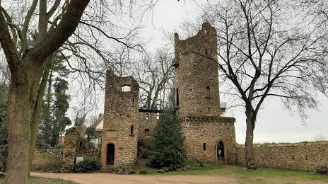
Photo
Where is located Verna-Park (Stadtpark)
Verna-Park (Stadtpark) — local attraction, which is located at 65428 Rüsselsheim, Germany and belongs to the category — park. Average visitor rating for this place — 4.5 (according to 311 ratings, information from open sources and relevant for 2022).
Exact location — Verna-Park (Stadtpark), marked on the map with a red marker.
You can get directions to Verna-Park (Stadtpark) on the map from your location.
What else is interesting in Rüsselsheim? You can see all the sights if you go to the city page.
Coordinates
Verna-Park (Stadtpark), Germany coordinates in decimal format: latitude — 49.99713105388405, longitude — 8.415523998239946. When converted to degrees, minutes, seconds Verna-Park (Stadtpark) has the following coordinates: 49°59′49.67 north latitude and 8°24′55.89 east longitude.
Nearby cities
The largest cities that are located nearby:
- Mainz — 12 km
- Wiesbaden — 16 km
- Darmstadt — 21 km
- Frankfurt — 23 km
- Offenbach — 28 km
- Mannheim — 56 km
- Ludwigshafen — 57 km
- Heidelberg — 68 km
- Koblenz — 71 km
- Siegen — 103 km
- Karlsruhe — 109 km
- Heilbronn — 110 km
- Würzburg — 111 km
- Pforzheim — 123 km
- Bonn — 124 km
- Trier — 130 km
- Saarbrücken — 132 km
- Bergisch Gladbach — 143 km
- Stuttgart — 145 km
Distance to the capital
Distance to the capital (Berlin) is about — 446 km.