
 Gilserberg
Berlin
Bordesholm
Bechtolsheim
Aub
Triptis
Heppenheim
Biblis
Angermünde
Gilserberg
Berlin
Bordesholm
Bechtolsheim
Aub
Triptis
Heppenheim
Biblis
Angermünde
Kleiner De-Witt-See on the map, Nettetal, Germany
Photo
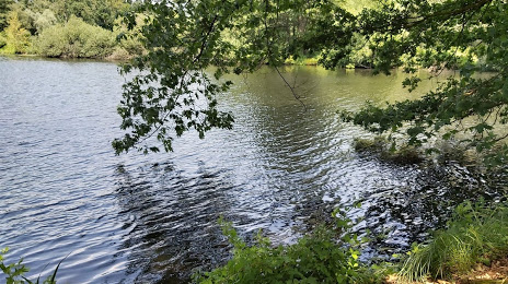
Where is located Kleiner De-Witt-See
Kleiner De-Witt-See — local attraction, which is located at no data and belongs to the category — -. Average visitor rating for this place — 4.8 (according to 12 ratings, information from open sources and relevant for 2022).
Exact location — Kleiner De-Witt-See, marked on the map with a red marker.
You can get directions to Kleiner De-Witt-See on the map from your location.
What else is interesting in Nettetal? You can see all the sights if you go to the city page.
Coordinates
Kleiner De-Witt-See, Germany coordinates in decimal format: latitude — 51.31945160402148, longitude — 6.245125698287994. When converted to degrees, minutes, seconds Kleiner De-Witt-See has the following coordinates: 51°19′10.03 north latitude and 6°14′42.45 east longitude.
Nearby cities
The largest cities that are located nearby:
- Mönchengladbach — 19 km
- Krefeld — 21 km
- Moers — 29 km
- Neuss — 31 km
- Düsseldorf — 35 km
- Duisburg — 35 km
- Mülheim — 43 km
- Oberhausen — 45 km
- Bottrop — 51 km
- Essen — 52 km
- Eindhoven
 (Netherlands) — 58 km
 - Solingen — 58 km
- Gelsenkirchen — 60 km
- Wuppertal — 60 km
- Aachen — 61 km
- Nijmegen (Netherlands) — 63 km
- Cologne — 63 km
- Remscheid — 65 km
- Maastricht (Netherlands) — 66 km
Distance to the capital
Distance to the capital (Berlin) is about — 509 km.