 Pointe-à-la-Croix
Sainte-Irène, Quebec
Marsoui
Hecla
Muskrat Dam
Wunnummin Lake
Sainte-Brigitte-de-Laval
Drayton
Mauricie
Pointe-à-la-Croix
Sainte-Irène, Quebec
Marsoui
Hecla
Muskrat Dam
Wunnummin Lake
Sainte-Brigitte-de-Laval
Drayton
Mauricie
Diana Lake Provincial Park on the map, Prince Rupert, Canada
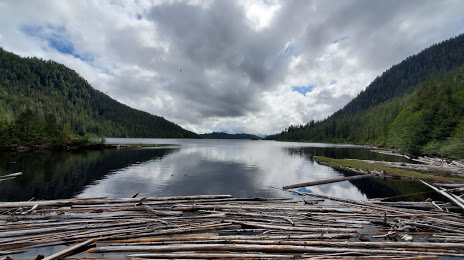
Photo
Where is located Diana Lake Provincial Park
Diana Lake Provincial Park — local attraction, which is located at 356 Spruce Ave, Port Edward, BC, Canada and belongs to the category — provincial park. Average visitor rating for this place — 4.5 (according to 57 ratings, information from open sources and relevant for 2022).
Exact location — Diana Lake Provincial Park, marked on the map with a red marker.
You can get directions to Diana Lake Provincial Park on the map from your location.
What else is interesting in Prince Rupert? You can see all the sights if you go to the city page.
Coordinates
Diana Lake Provincial Park, Canada coordinates in decimal format: latitude — 54.27069288538423, longitude — -130.30361419278316. When converted to degrees, minutes, seconds Diana Lake Provincial Park has the following coordinates: 54°16′14.49 north latitude and -130°18′13.01 east longitude.
Nearby cities
The largest cities that are located nearby:
- Vancouver — 761 km
- Burnaby — 770 km
- Richmond — 771 km
- Anmore — 771 km
- Coquitlam — 777 km
- Delta — 782 km
- Surrey — 783 km
- Abbotsford — 821 km
- Victoria — 827 km
- Kelowna — 913 km
- Seattle
 (United States) — 951 km
 - Bellevue (United States) — 957 km
- Tacoma (United States) — 979 km
- Edmonton — 1109 km
- Portland (United States) — 1138 km
- Salem (United States) — 1183 km
- Calgary — 1186 km
- Spokane (United States) — 1210 km
- Eugene (United States) — 1272 km
Distance to the capital
Distance to the capital (Ottawa) is about — 3932 km.