 Pointe-à-la-Croix
Sainte-Irène, Quebec
Marsoui
Hecla
Muskrat Dam
Wunnummin Lake
Sainte-Brigitte-de-Laval
Drayton
Mauricie
Pointe-à-la-Croix
Sainte-Irène, Quebec
Marsoui
Hecla
Muskrat Dam
Wunnummin Lake
Sainte-Brigitte-de-Laval
Drayton
Mauricie
Blow Me Down Cross Country Ski Club on the map, Corner Brook, Canada
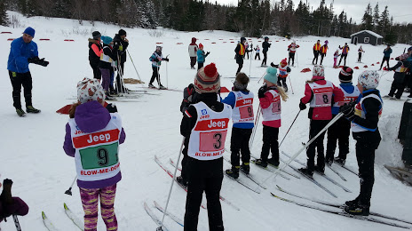
Photo
Where is located Blow Me Down Cross Country Ski Club
Blow Me Down Cross Country Ski Club — local attraction, which is located at Lundrigan Dr, Corner Brook, NL A2H 6G1, Canada and belongs to the category — ski club. Average visitor rating for this place — 4.8 (according to 44 ratings, information from open sources and relevant for 2022).
Exact location — Blow Me Down Cross Country Ski Club, marked on the map with a red marker.
You can get directions to Blow Me Down Cross Country Ski Club on the map from your location.
What else is interesting in Corner Brook? You can see all the sights if you go to the city page.
Coordinates
Blow Me Down Cross Country Ski Club, Canada coordinates in decimal format: latitude — 48.92249014744892, longitude — -57.99159290179842. When converted to degrees, minutes, seconds Blow Me Down Cross Country Ski Club has the following coordinates: 48°55′20.96 north latitude and -57°59′29.73 east longitude.
Nearby cities
The largest cities that are located nearby:
- Dartmouth — 648 km
- Halifax — 649 km
- Saguenay — 964 km
- Quebec — 1034 km
- Levis — 1037 km
- Trois-Rivières — 1151 km
- Sherbrooke — 1151 km
- Longueuil — 1263 km
- Montreal — 1269 km
- Laval — 1274 km
- Manchester
 (United States) — 1275 km
 - Lowell (United States) — 1292 km
- Boston (United States) — 1295 km
- Cambridge (United States) — 1298 km
- Worcester (United States) — 1353 km
- Providence (United States) — 1360 km
- Amherst (United States) — 1395 km
- Springfield (United States) — 1420 km
- Gatineau — 1429 km
Distance to the capital
Distance to the capital (Ottawa) is about — 1391 km.