 Pointe-à-la-Croix
Sainte-Irène, Quebec
Marsoui
Hecla
Muskrat Dam
Wunnummin Lake
Sainte-Brigitte-de-Laval
Drayton
Mauricie
Pointe-à-la-Croix
Sainte-Irène, Quebec
Marsoui
Hecla
Muskrat Dam
Wunnummin Lake
Sainte-Brigitte-de-Laval
Drayton
Mauricie
Lac à la Pêche on the map, Shawinigan, Canada
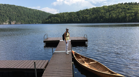
Photo
Where is located Lac à la Pêche
Lac à la Pêche — local attraction, which is located at Quebec and belongs to the category — -. Average visitor rating for this place — 4.5 (according to 4 ratings, information from open sources and relevant for 2022).
Exact location — Lac à la Pêche, marked on the map with a red marker.
You can get directions to Lac à la Pêche on the map from your location.
What else is interesting in Shawinigan? You can see all the sights if you go to the city page.
Coordinates
Lac à la Pêche, Canada coordinates in decimal format: latitude — 46.68197857260104, longitude — -72.85528112170054. When converted to degrees, minutes, seconds Lac à la Pêche has the following coordinates: 46°40′55.12 north latitude and -72°51′19.01 east longitude.
Nearby cities
The largest cities that are located nearby:
- Trois-Rivières — 29 km
- Levis — 115 km
- Quebec — 117 km
- Longueuil — 128 km
- Laval — 130 km
- Montreal — 133 km
- Sherbrooke — 145 km
- Saguenay — 240 km
- Gatineau — 259 km
- Kingston — 393 km
- Manchester
 (United States) — 408 km
 - Lowell (United States) — 450 km
- Amherst (United States) — 467 km
- Syracuse (United States) — 476 km
- Worcester (United States) — 482 km
- Cambridge (United States) — 482 km
- Boston (United States) — 485 km
- Springfield (United States) — 493 km
- Hartford (United States) — 531 km
Distance to the capital
Distance to the capital (Ottawa) is about — 260 km.