
 Gilserberg
Berlin
Bordesholm
Bechtolsheim
Aub
Triptis
Heppenheim
Biblis
Angermünde
Gilserberg
Berlin
Bordesholm
Bechtolsheim
Aub
Triptis
Heppenheim
Biblis
Angermünde
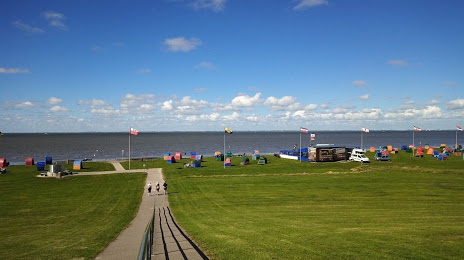
Strandbad Otterndorf-See on the map, Cuxhaven, Germany
Photo
Where is located Strandbad Otterndorf-See
Strandbad Otterndorf-See — local attraction, which is located at no data and belongs to the category — -. Average visitor rating for this place — 4.5 (according to 597 ratings, information from open sources and relevant for 2022).
Exact location — Strandbad Otterndorf-See, marked on the map with a red marker.
You can get directions to Strandbad Otterndorf-See on the map from your location.
What else is interesting in Cuxhaven? You can see all the sights if you go to the city page.
Coordinates
Strandbad Otterndorf-See, Germany coordinates in decimal format: latitude — 53.82748147546458, longitude — 8.882306698393025. When converted to degrees, minutes, seconds Strandbad Otterndorf-See has the following coordinates: 53°49′38.93 north latitude and 8°52′56.3 east longitude.
Nearby cities
The largest cities that are located nearby:
- Bremerhaven — 36 km
- Bremen — 87 km
- Kiel — 106 km
- Groningen
 (Netherlands) — 157 km
 - Emmen (Netherlands) — 169 km
- Hanover — 179 km
- Osnabrück — 180 km
- Odense
 (Denmark) — 202 km
 - Bielefeld — 202 km
- Hildesheim — 207 km
- Wolfsburg — 213 km
- Brunswick — 215 km
- Enschede (Netherlands) — 218 km
- Salzgitter — 219 km
- Münster — 222 km
- Rostock — 223 km
- Zwolle (Netherlands) — 230 km
- Paderborn — 237 km
- Hamm — 249 km
Distance to the capital
Distance to the capital (Berlin) is about — 335 km.