 Pointe-à-la-Croix
Sainte-Irène, Quebec
Marsoui
Hecla
Muskrat Dam
Wunnummin Lake
Sainte-Brigitte-de-Laval
Drayton
Mauricie
Pointe-à-la-Croix
Sainte-Irène, Quebec
Marsoui
Hecla
Muskrat Dam
Wunnummin Lake
Sainte-Brigitte-de-Laval
Drayton
Mauricie
Lionels Farm on the map, Whitchurch-Stouffville, Canada
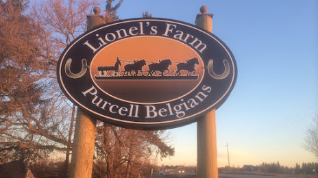
Photo
Where is located Lionels Farm
Lionels Farm — local attraction, which is located at 11714 McCowan Rd, Whitchurch-Stouffville, ON L4A 7X5, Canada and belongs to the category — farm. Average visitor rating for this place — 4.2 (according to 541 rating, information from open sources and relevant for 2022).
Exact location — Lionels Farm, marked on the map with a red marker.
You can get directions to Lionels Farm on the map from your location.
What else is interesting in Whitchurch-Stouffville? You can see all the sights if you go to the city page.
Coordinates
Lionels Farm, Canada coordinates in decimal format: latitude — 43.94490501316902, longitude — -79.3037183019678. When converted to degrees, minutes, seconds Lionels Farm has the following coordinates: 43°56′41.66 north latitude and -79°18′13.39 east longitude.
Nearby cities
The largest cities that are located nearby:
- Markham — 15 km
- Richmond Hill — 18 km
- Whitby — 25 km
- Vaughan — 26 km
- Oshawa — 31 km
- Toronto — 37 km
- Brampton — 49 km
- Mississauga — 53 km
- Barrie — 58 km
- Oakville — 66 km
- Burlington — 84 km
- Saint Catharines — 90 km
- Guelph — 93 km
- Hamilton — 94 km
- Cambridge — 109 km
- Amherst
 (United States) — 116 km
 - Kitchener — 117 km
- Waterloo — 117 km
- Buffalo (United States) — 123 km
Distance to the capital
Distance to the capital (Ottawa) is about — 329 km.