 Pointe-à-la-Croix
Sainte-Irène, Quebec
Marsoui
Hecla
Muskrat Dam
Wunnummin Lake
Sainte-Brigitte-de-Laval
Drayton
Mauricie
Pointe-à-la-Croix
Sainte-Irène, Quebec
Marsoui
Hecla
Muskrat Dam
Wunnummin Lake
Sainte-Brigitte-de-Laval
Drayton
Mauricie
Parc de la Frayère on the map, Boucherville, Canada
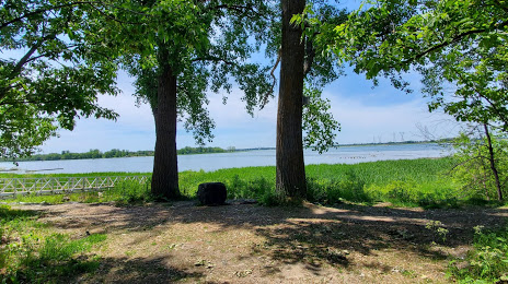
Photo
Where is located Parc de la Frayère
Parc de la Frayère — local attraction, which is located at 1149 Bd Marie-Victorin, Boucherville, QC J4B 0B6, Canada and belongs to the category — park. Average visitor rating for this place — 4.5 (according to 239 ratings, information from open sources and relevant for 2022).
Exact location — Parc de la Frayère, marked on the map with a red marker.
You can get directions to Parc de la Frayère on the map from your location.
What else is interesting in Boucherville? You can see all the sights if you go to the city page.
Coordinates
Parc de la Frayère, Canada coordinates in decimal format: latitude — 45.64556174054726, longitude — -73.44348380191157. When converted to degrees, minutes, seconds Parc de la Frayère has the following coordinates: 45°38′44.02 north latitude and -73°26′36.54 east longitude.
Nearby cities
The largest cities that are located nearby:
- Longueuil — 8 km
- Montreal — 14 km
- Laval — 21 km
- Trois-Rivières — 108 km
- Sherbrooke — 122 km
- Gatineau — 176 km
- Levis — 209 km
- Quebec — 213 km
- Kingston — 285 km
- Manchester
 (United States) — 329 km
 - Syracuse (United States) — 356 km
- Saguenay — 359 km
- Amherst (United States) — 368 km
- Lowell (United States) — 370 km
- Worcester (United States) — 392 km
- Springfield (United States) — 392 km
- Cambridge (United States) — 403 km
- Boston (United States) — 407 km
- Hartford (United States) — 428 km
Distance to the capital
Distance to the capital (Ottawa) is about — 177 km.