 Pointe-à-la-Croix
Sainte-Irène, Quebec
Marsoui
Hecla
Muskrat Dam
Wunnummin Lake
Sainte-Brigitte-de-Laval
Drayton
Mauricie
Pointe-à-la-Croix
Sainte-Irène, Quebec
Marsoui
Hecla
Muskrat Dam
Wunnummin Lake
Sainte-Brigitte-de-Laval
Drayton
Mauricie
Carré Royal on the map, Sorel, Canada
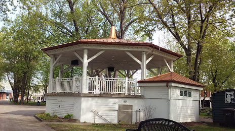
Photo
Where is located Carré Royal
Carré Royal — local attraction, which is located at 75 Rue du Roi, Sorel-Tracy, QC J3P 7K1, Canada and belongs to the category — park. Average visitor rating for this place — 4.3 (according to 357 ratings, information from open sources and relevant for 2022).
Exact location — Carré Royal, marked on the map with a red marker.
You can get directions to Carré Royal on the map from your location.
What else is interesting in Sorel? You can see all the sights if you go to the city page.
Coordinates
Carré Royal, Canada coordinates in decimal format: latitude — 46.044004382622475, longitude — -73.11498590189805. When converted to degrees, minutes, seconds Carré Royal has the following coordinates: 46°2′38.42 north latitude and -73°6′53.95 east longitude.
Nearby cities
The largest cities that are located nearby:
- Trois-Rivières — 55 km
- Longueuil — 64 km
- Laval — 67 km
- Montreal — 69 km
- Sherbrooke — 119 km
- Levis — 161 km
- Quebec — 165 km
- Gatineau — 210 km
- Saguenay — 303 km
- Kingston — 334 km
- Manchester
 (United States) — 363 km
 - Lowell (United States) — 404 km
- Syracuse (United States) — 412 km
- Amherst (United States) — 412 km
- Worcester (United States) — 431 km
- Cambridge (United States) — 437 km
- Springfield (United States) — 438 km
- Boston (United States) — 440 km
- Hartford (United States) — 474 km
Distance to the capital
Distance to the capital (Ottawa) is about — 212 km.