
Other locations
CHAMPAS CORRIENTES  La Ensenada
Obero
Cuilapa
Laguna de Montebello
Uaxactun
Melchor de Mencos
Petetan
El Subin
Patanatic
La Ensenada
Obero
Cuilapa
Laguna de Montebello
Uaxactun
Melchor de Mencos
Petetan
El Subin
Patanatic
Pacaya on the map, Guatemala City, Guatemala
Comments
Where is located Pacaya on the map, Guatemala City, Guatemala. Geographic coordinates in decimal format, as well as degrees, minutes and seconds. Photo, address and average rating of visitors who have been here.
Photo
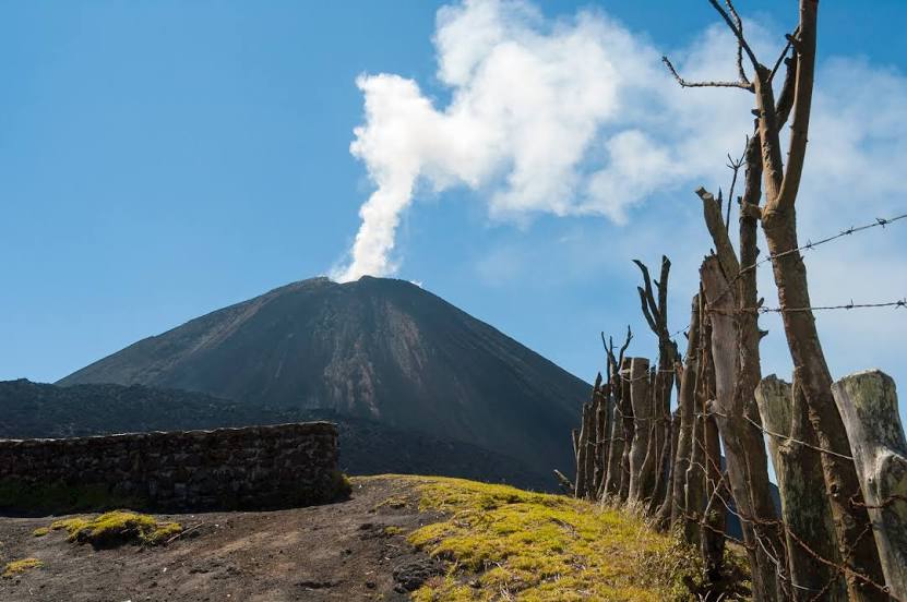
Where is located Pacaya
Pacaya — local attraction, which is located at 2,552 m and belongs to the category — -. Average visitor rating for this place — 4.5 (according to 539 ratings, information from open sources and relevant for 2022).
Exact location — Pacaya, marked on the map with a red marker.
You can get directions to Pacaya on the map from your location.
What else is interesting in Guatemala City? You can see all the sights if you go to the city page.
Coordinates
Pacaya, Guatemala coordinates in decimal format: latitude — 14.384260355242217, longitude — -90.60150726724177. When converted to degrees, minutes, seconds Pacaya has the following coordinates: 14°23′3.34 north latitude and -90°36′5.43 east longitude.
Nearby cities
The largest cities that are located nearby:
- Villa Nueva — 11 km
- Villa Canales — 15 km
- San Juan Sacatepéquez — 16 km
- Escuintla — 44 km
- Quetzaltenango — 108 km
- Santa Ana
 (El Salvador) — 126 km
 - Santa Tecla (El Salvador) — 169 km
- Apopa (El Salvador) — 171 km
- Mejicanos (El Salvador) — 172 km
- San Salvador (El Salvador) — 174 km
- Soyapango (El Salvador) — 180 km
- Tapachula
 (Mexico) — 187 km
 - San Miguel (El Salvador) — 283 km
- San Pedro Sula
 (Honduras) — 284 km
 - Choloma (Honduras) — 297 km
- El Progreso (Honduras) — 304 km
- San Cristóbal de las Casas (Mexico) — 324 km
- Tuxtla Gutiérrez (Mexico) — 360 km
- Tegucigalpa (Honduras) — 361 km