
 Belém
Maranguape
Paranaguá
Paranaguá
Monte Alegre
Alvorada de Minas
Bragança
Laguna
Ibiporã
Belém
Maranguape
Paranaguá
Paranaguá
Monte Alegre
Alvorada de Minas
Bragança
Laguna
Ibiporã
Parque Villa-Lobos on the map, São Paulo, Brazil
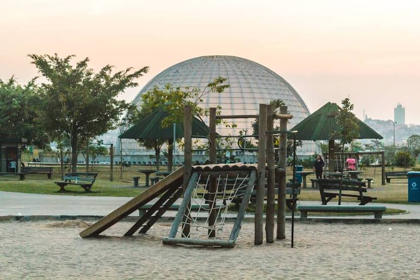
Photo
Where is located Parque Villa-Lobos
Parque Villa-Lobos — local attraction, which is located at Av. Prof. Fonseca Rodrigues, 2001 - Alto de Pinheiros, São Paulo - SP, 05461-010, Brazil and belongs to the category — state park. Average visitor rating for this place — 4.6 (according to 71733 ratings, information from open sources and relevant for 2022).
Exact location — Parque Villa-Lobos, marked on the map with a red marker.
You can get directions to Parque Villa-Lobos on the map from your location.
What else is interesting in São Paulo? You can see all the sights if you go to the city page.
Coordinates
Parque Villa-Lobos, Brazil coordinates in decimal format: latitude — -23.545788262524788, longitude — -46.7254151026559. When converted to degrees, minutes, seconds Parque Villa-Lobos has the following coordinates: -23°32′44.84 north latitude and -46°43′31.49 east longitude.
Nearby cities
The largest cities that are located nearby:
- São Caetano do Sul — 11 km
- Diadema — 15 km
- Guarulhos — 15 km
- Osasco — 16 km
- Saint Andrew — 16 km
- São Bernardo do Campo — 17 km
- Taboão da Serra — 17 km
- Carapicuiba — 21 km
- Mauá — 22 km
- Barueri — 25 km
- Franco da Rocha — 27 km
- Jandira — 27 km
- Ribeirão Pires — 29 km
- Poá — 29 km
- Cotia — 30 km
- Itaquaquecetuba — 30 km
- Itapevi — 30 km
- Francisco Morato — 32 km
- Suzano — 33 km