
 Puerto de la Duquesa
La Serna de Iguña
Pumalverde
Puentenansa
La Iglesia
Casar de Periedo
Fuengirola
Renedo de Piélagos
Villabanez
Puerto de la Duquesa
La Serna de Iguña
Pumalverde
Puentenansa
La Iglesia
Casar de Periedo
Fuengirola
Renedo de Piélagos
Villabanez
Parque Ribera De Castilla on the map, Valladolid, Spain
Photo
Where is located Parque Ribera De Castilla
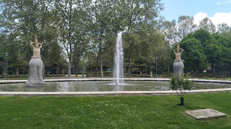
Parque Ribera De Castilla — local attraction, which is located at C. Rábida, 4, 47010 Valladolid, Spain and belongs to the category — park. Average visitor rating for this place — 4.5 (according to 921 rating, information from open sources and relevant for 2022).
Exact location — Parque Ribera De Castilla, marked on the map with a red marker.
You can get directions to Parque Ribera De Castilla on the map from your location.
What else is interesting in Valladolid? You can see all the sights if you go to the city page.
Coordinates
Parque Ribera De Castilla, Spain coordinates in decimal format: latitude — 41.66557860502804, longitude — -4.722270402199021. When converted to degrees, minutes, seconds Parque Ribera De Castilla has the following coordinates: 41°39′56.08 north latitude and -4°43′20.17 east longitude.
Nearby cities
The largest cities that are located nearby:
- Salamanca — 109 km
- Burgos — 114 km
- León — 125 km
- Alcobendas — 153 km
- Alcorcón — 163 km
- Móstoles — 164 km
- Leganés — 167 km
- Torrejón de Ardoz — 169 km
- Fuenlabrada — 169 km
- Getafe — 171 km
- Alcala de Henares — 173 km
- Logroño — 206 km
- Oviedo — 210 km
- Vitoria-Gasteiz — 213 km
- Santander — 213 km
- Gijón — 221 km
- Bilbao — 229 km
- Ourense — 267 km
- Pamplona — 281 km
Distance to the capital
Distance to the capital (Madrid) is about — 163 km.