
 Gilserberg
Berlin
Bordesholm
Bechtolsheim
Aub
Triptis
Heppenheim
Biblis
Angermünde
Gilserberg
Berlin
Bordesholm
Bechtolsheim
Aub
Triptis
Heppenheim
Biblis
Angermünde
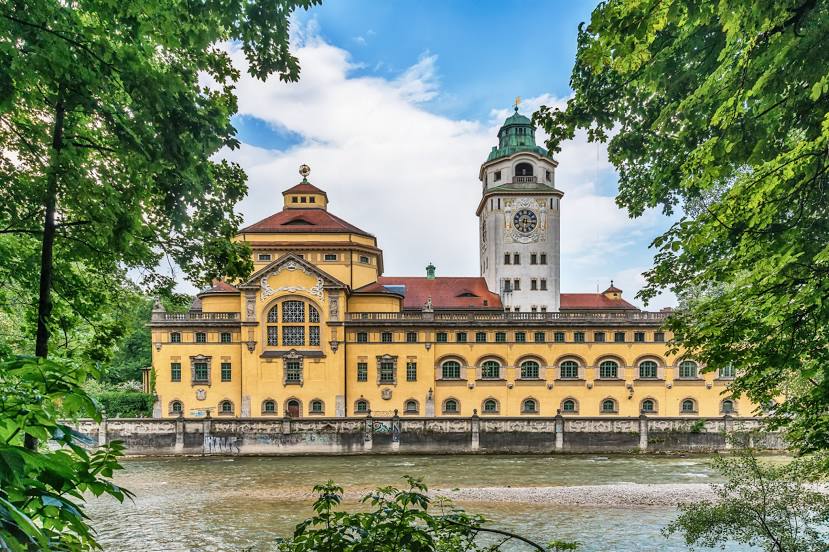
Müllersches Volksbad on the map, Munich, Germany
Photo
Where is located Müllersches Volksbad
Müllersches Volksbad — local attraction, which is located at Rosenheimer Str. 1, 81667 München, Germany and belongs to the category — public swimming pool. Average visitor rating for this place — 4.4 (according to 1301 rating, information from open sources and relevant for 2022).
Exact location — Müllersches Volksbad, marked on the map with a red marker.
You can get directions to Müllersches Volksbad on the map from your location.
What else is interesting in Munich? You can see all the sights if you go to the city page.
Coordinates
Müllersches Volksbad, Germany coordinates in decimal format: latitude — 48.1323163764324, longitude — 11.588409598015323. When converted to degrees, minutes, seconds Müllersches Volksbad has the following coordinates: 48°7′56.34 north latitude and 11°35′18.27 east longitude.
Nearby cities
The largest cities that are located nearby:
- Augsburg — 57 km
- Ingolstadt — 71 km
- Innsbruck
 (Austria) — 97 km
 - Regensburg — 104 km
- Salzburg (Austria) — 115 km
- Ulm — 121 km
- Nuremberg — 150 km
- Fürth — 154 km
- Erlangen — 166 km
- Reutlingen — 179 km
- Stuttgart — 189 km
- Linz (Austria) — 200 km
- Heilbronn — 205 km
- Würzburg — 217 km
- Pilsen
 (Czech Republic) — 219 km
 - Pforzheim — 226 km
- Trento
 (Italy) — 231 km
 - Zurich
 (Switzerland) — 243 km
 - Karlsruhe — 250 km
Distance to the capital
Distance to the capital (Berlin) is about — 505 km.