 Pointe-à-la-Croix
Sainte-Irène, Quebec
Marsoui
Hecla
Muskrat Dam
Wunnummin Lake
Sainte-Brigitte-de-Laval
Drayton
Mauricie
Pointe-à-la-Croix
Sainte-Irène, Quebec
Marsoui
Hecla
Muskrat Dam
Wunnummin Lake
Sainte-Brigitte-de-Laval
Drayton
Mauricie
Club de Golf Baie Comeau on the map, Baie-Comeau, Canada
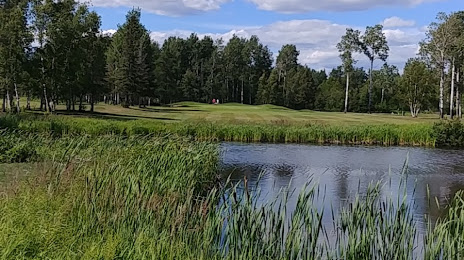
Photo
Where is located Club de Golf Baie Comeau
Club de Golf Baie Comeau — local attraction, which is located at 1700 Rue de Bretagne, Baie-Comeau, QC G5C 3S3, Canada and belongs to the category — golf club. Average visitor rating for this place — 4.4 (according to 30 ratings, information from open sources and relevant for 2022).
Exact location — Club de Golf Baie Comeau, marked on the map with a red marker.
You can get directions to Club de Golf Baie Comeau on the map from your location.
What else is interesting in Baie-Comeau? You can see all the sights if you go to the city page.
Coordinates
Club de Golf Baie Comeau, Canada coordinates in decimal format: latitude — 49.14888546978812, longitude — -68.30199674858012. When converted to degrees, minutes, seconds Club de Golf Baie Comeau has the following coordinates: 49°8′55.99 north latitude and -68°18′7.19 east longitude.
Nearby cities
The largest cities that are located nearby:
- Saguenay — 231 km
- Quebec — 355 km
- Levis — 361 km
- Trois-Rivières — 462 km
- Sherbrooke — 512 km
- Longueuil — 582 km
- Laval — 587 km
- Montreal — 588 km
- Dartmouth — 619 km
- Halifax — 621 km
- Gatineau — 717 km
- Manchester
 (United States) — 738 km
 - Lowell (United States) — 773 km
- Cambridge (United States) — 795 km
- Boston (United States) — 795 km
- Worcester (United States) — 825 km
- Amherst (United States) — 840 km
- Kingston — 861 km
- Providence (United States) — 861 km
Distance to the capital
Distance to the capital (Ottawa) is about — 695 km.