
 Paradise
Groot Henar
Longmay
Clarapolder
Drietabbetje
Jacobkondre
Paramaribo
Powakka
Brownsweg
Paradise
Groot Henar
Longmay
Clarapolder
Drietabbetje
Jacobkondre
Paramaribo
Powakka
Brownsweg
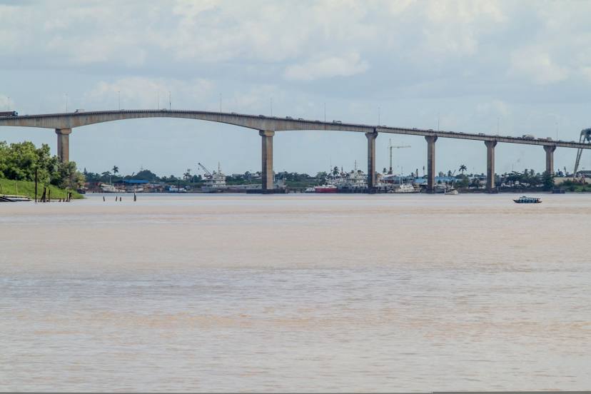
Jules Wijdenbosch bridge (Jules Wijdenboschbrug) on the map, Paramaribo, Suriname
Photo
Where is located Jules Wijdenbosch bridge (Jules Wijdenboschbrug)
Jules Wijdenbosch bridge (Jules Wijdenboschbrug) — local attraction, which is located at Jules Wijdenbosch Bridge, Jules Wijdenboschbrug, Suriname and belongs to the category — box girder bridge. Average visitor rating for this place — 4.0 (according to 50 ratings, information from open sources and relevant for 2022).
Exact location — Jules Wijdenbosch bridge (Jules Wijdenboschbrug), marked on the map with a red marker.
You can get directions to Jules Wijdenbosch bridge (Jules Wijdenboschbrug) on the map from your location.
What else is interesting in Paramaribo? You can see all the sights if you go to the city page.
Coordinates
Jules Wijdenbosch bridge (Jules Wijdenboschbrug), Suriname coordinates in decimal format: latitude — 5.805385197733434, longitude — -55.16274759477205. When converted to degrees, minutes, seconds Jules Wijdenbosch bridge (Jules Wijdenboschbrug) has the following coordinates: 5°48′19.39 north latitude and -55°9′45.89 east longitude.
Nearby cities
The largest cities that are located nearby:
- Georgetown
 (Guyana) — 342 km
 - Boa Vista
 (Brazil) — 691 km
 - Macapá (Brazil) — 789 km
- Valencia
 (Trinidad and Tobago) — 840 km
 - Santarém (Brazil) — 920 km
- Ciudad Bolivar
 (Venezuela) — 947 km
 - Maturin (Venezuela) — 970 km
- Carupano (Venezuela) — 1023 km
- El Tigre (Venezuela) — 1042 km
- Anaco (Venezuela) — 1085 km
- Belém (Brazil) — 1097 km
- Ananindeua (Brazil) — 1098 km
- Cumaná (Venezuela) — 1100 km
- Manaus (Brazil) — 1125 km
- Castanhal (Brazil) — 1129 km
- Puerto La Cruz (Venezuela) — 1133 km
- Barcelona (Venezuela) — 1135 km
- Guatire (Venezuela) — 1335 km
- Guarenas (Venezuela) — 1342 km