
 Gilserberg
Berlin
Bordesholm
Bechtolsheim
Aub
Triptis
Heppenheim
Biblis
Angermünde
Gilserberg
Berlin
Bordesholm
Bechtolsheim
Aub
Triptis
Heppenheim
Biblis
Angermünde
Walderlebnispfad on the map, Freising, Germany
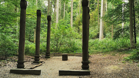
Photo
Where is located Walderlebnispfad
Walderlebnispfad — local attraction, which is located at Plantage 2, 85354 Freising, Germany and belongs to the category — national forest. Average visitor rating for this place — 4.7 (according to 557 ratings, information from open sources and relevant for 2022).
Exact location — Walderlebnispfad, marked on the map with a red marker.
You can get directions to Walderlebnispfad on the map from your location.
What else is interesting in Freising? You can see all the sights if you go to the city page.
Coordinates
Walderlebnispfad, Germany coordinates in decimal format: latitude — 48.41628873315174, longitude — 11.727653507892972. When converted to degrees, minutes, seconds Walderlebnispfad has the following coordinates: 48°24′58.64 north latitude and 11°43′39.55 east longitude.
Nearby cities
The largest cities that are located nearby:
- Munich — 32 km
- Ingolstadt — 46 km
- Augsburg — 62 km
- Regensburg — 72 km
- Salzburg
 (Austria) — 118 km
 - Nuremberg — 125 km
- Innsbruck (Austria) — 128 km
- Ulm — 129 km
- Fürth — 130 km
- Erlangen — 141 km
- Reutlingen — 186 km
- Linz (Austria) — 187 km
- Pilsen
 (Czech Republic) — 188 km
 - Stuttgart — 191 km
- Würzburg — 200 km
- Heilbronn — 200 km
- Pforzheim — 228 km
- Heidelberg — 247 km
- Karlsruhe — 251 km
Distance to the capital
Distance to the capital (Berlin) is about — 472 km.