
 Gilserberg
Berlin
Bordesholm
Bechtolsheim
Aub
Triptis
Heppenheim
Biblis
Angermünde
Gilserberg
Berlin
Bordesholm
Bechtolsheim
Aub
Triptis
Heppenheim
Biblis
Angermünde
Teltow Region Industrial Museum on the map, Stahnsdorf, Germany
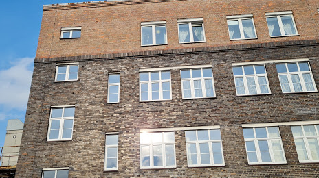
Photo
Where is located Teltow Region Industrial Museum
Teltow Region Industrial Museum — local attraction, which is located at Oderstraße 23-25, 14513 Teltow, Germany and belongs to the category — museum. Average visitor rating for this place — 3.9 (according to 34 ratings, information from open sources and relevant for 2022).
Exact location — Teltow Region Industrial Museum, marked on the map with a red marker.
You can get directions to Teltow Region Industrial Museum on the map from your location.
What else is interesting in Stahnsdorf? You can see all the sights if you go to the city page.
Coordinates
Teltow Region Industrial Museum, Germany coordinates in decimal format: latitude — 52.40460676156959, longitude — 13.253996408037423. When converted to degrees, minutes, seconds Teltow Region Industrial Museum has the following coordinates: 52°24′16.58 north latitude and 13°15′14.39 east longitude.
Nearby cities
The largest cities that are located nearby:
- Potsdam — 10 km
- Berlin — 17 km
- Cottbus — 103 km
- Magdeburg — 112 km
- Leipzig — 129 km
- Gorzów Wielkopolski
 (Poland) — 141 km
 - Szczecin (Poland) — 145 km
- Dresden — 152 km
- Zielona Gora (Poland) — 164 km
- Wolfsburg — 164 km
- Chemnitz — 173 km
- Brunswick — 182 km
- Gera — 184 km
- Salzgitter — 197 km
- Rostock — 202 km
- Erfurt — 217 km
- Hildesheim — 223 km
- Hanover — 235 km
- Legnica (Poland) — 242 km
Distance to the capital
Distance to the capital (Berlin) is about — 16 km.