
 Puerto de la Duquesa
La Serna de Iguña
Pumalverde
Puentenansa
La Iglesia
Casar de Periedo
Fuengirola
Renedo de Piélagos
Villabanez
Puerto de la Duquesa
La Serna de Iguña
Pumalverde
Puentenansa
La Iglesia
Casar de Periedo
Fuengirola
Renedo de Piélagos
Villabanez
Muelle De Añaza on the map, Santa Cruz de Tenerife, Spain
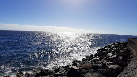
Photo
Where is located Muelle De Añaza
Muelle De Añaza — local attraction, which is located at 38111 Santa Cruz de Tenerife, Spain and belongs to the category — fishing pier. Average visitor rating for this place — 4.3 (according to 38 ratings, information from open sources and relevant for 2022).
Exact location — Muelle De Añaza, marked on the map with a red marker.
You can get directions to Muelle De Añaza on the map from your location.
What else is interesting in Santa Cruz de Tenerife? You can see all the sights if you go to the city page.
Coordinates
Muelle De Añaza, Spain coordinates in decimal format: latitude — 28.42015133185378, longitude — -16.295663992687995. When converted to degrees, minutes, seconds Muelle De Añaza has the following coordinates: 28°25′12.54 north latitude and -16°17′44.39 east longitude.
Nearby cities
The largest cities that are located nearby:
- Las Palmas de Gran Canaria — 88 km
- Telde — 97 km
- Agadir
 (Morocco) — 670 km
 - Essaouira (Morocco) — 698 km
- Safi (Morocco) — 782 km
- Marrakesh (Morocco) — 851 km
- El Jadida (Morocco) — 890 km
- Ouarzazate (Morocco) — 925 km
- Casablanca (Morocco) — 978 km
- Azilal (Morocco) — 987 km
- Khouribga (Morocco) — 995 km
- Mohammedia (Morocco) — 999 km
- Temara (Morocco) — 1049 km
- Sale (Morocco) — 1065 km
- Kenitra (Morocco) — 1091 km
- Khenifra (Morocco) — 1100 km
- Khemisset (Morocco) — 1107 km
- Nouakchott
 (Mauritania) — 1146 km
 - Meknes (Morocco) — 1151 km
Distance to the capital
Distance to the capital (Madrid) is about — 1761 km.