
 Józefów nad Wisłą
Gorzyce Wielkie
Rogówek
Sromowce Niżne
Wyszków County
Kruszewo
Jantar
Sady Górne
Nagoszewo
Józefów nad Wisłą
Gorzyce Wielkie
Rogówek
Sromowce Niżne
Wyszków County
Kruszewo
Jantar
Sady Górne
Nagoszewo
Warsaw Ghetto Museum on the map, Warsaw, Poland
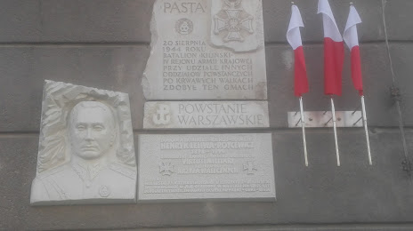
Photo
Where is located Warsaw Ghetto Museum
Warsaw Ghetto Museum — local attraction, which is located at Zielna 39, 00-108 Warszawa, Poland and belongs to the category — museum. Average visitor rating for this place — 4.1 (according to 19 ratings, information from open sources and relevant for 2022).
Exact location — Warsaw Ghetto Museum, marked on the map with a red marker.
You can get directions to Warsaw Ghetto Museum on the map from your location.
What else is interesting in Warsaw? You can see all the sights if you go to the city page.
Coordinates
Warsaw Ghetto Museum, Poland coordinates in decimal format: latitude — 52.240034944468476, longitude — 20.994819272237955. When converted to degrees, minutes, seconds Warsaw Ghetto Museum has the following coordinates: 52°14′24.13 north latitude and 20°59′41.35 east longitude.
Nearby cities
The largest cities that are located nearby:
- Radom — 92 km
- Plock — 95 km
- Łódź — 119 km
- Wloclawek — 138 km
- Lublin — 153 km
- Kielce — 153 km
- Bialystok — 174 km
- Olsztyn — 175 km
- Torun — 182 km
- Brest
 (Belarus) — 185 km
 - Częstochowa — 205 km
- Kalisz — 207 km
- Bydgoszcz — 222 km
- Elblag — 237 km
- Tarnow — 245 km
- Dabrowa Gornicza — 247 km
- Kraków — 251 km
- Rzeszow — 252 km
- Sosnowiec — 254 km