
 Gilserberg
Berlin
Bordesholm
Bechtolsheim
Aub
Triptis
Heppenheim
Biblis
Angermünde
Gilserberg
Berlin
Bordesholm
Bechtolsheim
Aub
Triptis
Heppenheim
Biblis
Angermünde
Krankenhaus-Museum on the map, Bremen, Germany
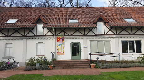
Photo
Where is located Krankenhaus-Museum
Krankenhaus-Museum — local attraction, which is located at Züricher Str. 40, 28325 Bremen, Germany and belongs to the category — museum. Average visitor rating for this place — 4.1 (according to 24 ratings, information from open sources and relevant for 2022).
Exact location — Krankenhaus-Museum, marked on the map with a red marker.
You can get directions to Krankenhaus-Museum on the map from your location.
What else is interesting in Bremen? You can see all the sights if you go to the city page.
Coordinates
Krankenhaus-Museum, Germany coordinates in decimal format: latitude — 53.06568105130932, longitude — 8.937798808062091. When converted to degrees, minutes, seconds Krankenhaus-Museum has the following coordinates: 53°3′56.45 north latitude and 8°56′16.08 east longitude.
Nearby cities
The largest cities that are located nearby:
- Bremerhaven — 53 km
- Hanover — 100 km
- Osnabrück — 102 km
- Bielefeld — 117 km
- Hildesheim — 129 km
- Emmen
 (Netherlands) — 131 km
 - Salzgitter — 146 km
- Brunswick — 147 km
- Münster — 147 km
- Groningen (Netherlands) — 149 km
- Paderborn — 150 km
- Wolfsburg — 152 km
- Enschede (Netherlands) — 160 km
- Kiel — 162 km
- Hamm — 169 km
- Göttingen — 187 km
- Zwolle (Netherlands) — 193 km
- Recklinghausen — 196 km
- Dortmund — 196 km
Distance to the capital
Distance to the capital (Berlin) is about — 306 km.