
 Belém
Maranguape
Paranaguá
Paranaguá
Monte Alegre
Alvorada de Minas
Bragança
Laguna
Ibiporã
Belém
Maranguape
Paranaguá
Paranaguá
Monte Alegre
Alvorada de Minas
Bragança
Laguna
Ibiporã
Itamaraty Palace on the map, Brasília, Brazil
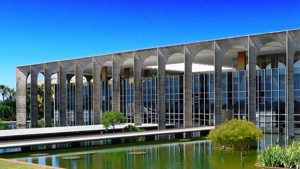
Photo
Where is located Itamaraty Palace
Itamaraty Palace — local attraction, which is located at Zona Cívico-Administrativa BL H - Brasília, DF, 70170-900, Brazil and belongs to the category — building. Average visitor rating for this place — 4.6 (according to 708 ratings, information from open sources and relevant for 2022).
Exact location — Itamaraty Palace, marked on the map with a red marker.
You can get directions to Itamaraty Palace on the map from your location.
What else is interesting in Brasília? You can see all the sights if you go to the city page.
Coordinates
Itamaraty Palace, Brazil coordinates in decimal format: latitude — -15.797748992455904, longitude — -47.84798465951406. When converted to degrees, minutes, seconds Itamaraty Palace has the following coordinates: -15°47′51.9 north latitude and -47°50′52.74 east longitude.
Nearby cities
The largest cities that are located nearby:
- Luziânia — 51 km
- Anápolis — 128 km
- Goiânia — 177 km
- Patos de Minas — 340 km
- Uberlândia — 347 km
- Uberaba — 437 km
- Montes Claros — 438 km
- Barreiras — 510 km
- Franca — 527 km
- Barretos — 531 km
- Sete Lagoas — 555 km
- Divinópolis — 572 km
- Esmeraldas — 587 km
- Ribeirão das Neves — 590 km
- Ribeirão Preto — 594 km
- Betim — 599 km
- Catanduva — 601 km
- Santa Luzia — 603 km
- Contagem — 603 km