 Pointe-à-la-Croix
Sainte-Irène, Quebec
Marsoui
Hecla
Muskrat Dam
Wunnummin Lake
Sainte-Brigitte-de-Laval
Drayton
Mauricie
Pointe-à-la-Croix
Sainte-Irène, Quebec
Marsoui
Hecla
Muskrat Dam
Wunnummin Lake
Sainte-Brigitte-de-Laval
Drayton
Mauricie
Pointe-des-Cascades Nature Park on the map, Beauharnois, Canada
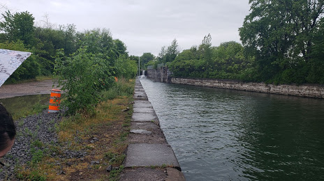
Photo
Where is located Pointe-des-Cascades Nature Park
Pointe-des-Cascades Nature Park — local attraction, which is located at 3 Chem. du Canal, Pointe-des-Cascades, QC J0P 1M0, Canada and belongs to the category — park. Average visitor rating for this place — 3.7 (according to 27 ratings, information from open sources and relevant for 2022).
Exact location — Pointe-des-Cascades Nature Park, marked on the map with a red marker.
You can get directions to Pointe-des-Cascades Nature Park on the map from your location.
What else is interesting in Beauharnois? You can see all the sights if you go to the city page.
Coordinates
Pointe-des-Cascades Nature Park, Canada coordinates in decimal format: latitude — 45.47261172776706, longitude — -73.7588029344452. When converted to degrees, minutes, seconds Pointe-des-Cascades Nature Park has the following coordinates: 45°28′21.4 north latitude and -73°45′31.69 east longitude.
Nearby cities
The largest cities that are located nearby:
- Montreal — 32 km
- Laval — 35 km
- Longueuil — 38 km
- Gatineau — 142 km
- Trois-Rivières — 153 km
- Sherbrooke — 155 km
- Kingston — 239 km
- Levis — 254 km
- Quebec — 259 km
- Syracuse
 (United States) — 311 km
 - Manchester (United States) — 323 km
- Amherst (United States) — 348 km
- Lowell (United States) — 362 km
- Springfield (United States) — 371 km
- Worcester (United States) — 378 km
- Rochester (United States) — 384 km
- Cambridge (United States) — 396 km
- Boston (United States) — 400 km
- Saguenay — 401 km
Distance to the capital
Distance to the capital (Ottawa) is about — 151 km.